IMAGES TAKEN NEAR TO
Matthews Road, CAMBERLEY, GU15 4LY
Introduction
This page details the photographs taken nearby to Matthews Road, GU15 4LY by members of the Geograph project.
The Geograph project started in 2005 with the aim of publishing, organising and preserving representative images for every square kilometre of Great Britain, Ireland and the Isle of Man.

There are currently over 7.5m images from over14,400 individuals and you can help contribute to the project by visiting https://www.geograph.org.uk
Image Map
Images are licensed for reuse under creativecommons.org/licenses/by-sa/2.0
Notes
- Clicking on the map will re-center to the selected point.
- The higher the marker number, the further away the image location is from the centre of the postcode.
Image Listing (35 Images Found)
Images are licensed for reuse under creativecommons.org/licenses/by-sa/2.0
Image
Details
Distance
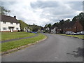
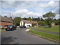
4
Matthews Road, Camberley
The military housing estate where it meets the heath and woodland.
Image: © Andrew Smith
Taken: 18 Feb 2006
0.04 miles
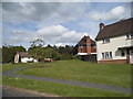
8
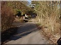
Entrance barrier, Olddean Common
The entrance to the army training area on Olddean Common from the top of King's Ride.
Image: © Alan Hunt
Taken: 19 Feb 2013
0.07 miles
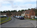
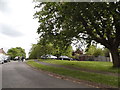
9
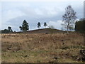
Looking east from Wishmoor Bottom
Looking up to the western end of Saddleback Hill. As you can see the area is a lot less wooded than how it is portrayed by the Ordnance Survey.
Image: © Andrew Smith
Taken: 18 Feb 2006
0.10 miles
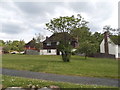
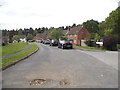
10
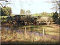
Olddean Common
Two well camouflaged army lorries near the entrance to this large military training area.
Image: © Alan Hunt
Taken: 19 Feb 2013
0.10 miles