IMAGES TAKEN NEAR TO
Wallington Road, CAMBERLEY, GU15 4BL
Introduction
This page details the photographs taken nearby to Wallington Road, GU15 4BL by members of the Geograph project.
The Geograph project started in 2005 with the aim of publishing, organising and preserving representative images for every square kilometre of Great Britain, Ireland and the Isle of Man.

There are currently over 7.5m images from over14,400 individuals and you can help contribute to the project by visiting https://www.geograph.org.uk
Image Map
Images are licensed for reuse under creativecommons.org/licenses/by-sa/2.0
Notes
- Clicking on the map will re-center to the selected point.
- The higher the marker number, the further away the image location is from the centre of the postcode.
Image Listing (13 Images Found)
Images are licensed for reuse under creativecommons.org/licenses/by-sa/2.0
Image
Details
Distance
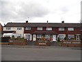
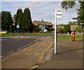
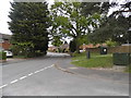
3
Bracknell Road at the junction of Wimbledon Road
Image: © David Howard
Taken: 17 May 2015
0.09 miles
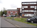
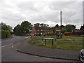
4
Kingston Road, Old Dean
Kingston Road roundabout, close to Collingwood school/college, on Old Dean, Camberley Housing estate built early 1960's
Image: © Roger
Taken: Unknown
0.09 miles
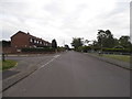
5
Bracknell Road at the junction of Kingston Road
Image: © David Howard
Taken: 17 May 2015
0.11 miles
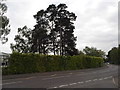
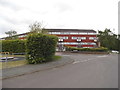
8
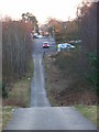
Bracknell Road
Looking southwards from the heath into the suburbs of Camberley
Image: © Andrew Smith
Taken: 11 Feb 2006
0.16 miles
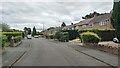
9
Wimbledon Road at the junction of Berkshire Road
Image: © David Howard
Taken: 17 May 2015
0.16 miles