IMAGES TAKEN NEAR TO
Old Pond Close, CAMBERLEY, GU15 2SL
Introduction
This page details the photographs taken nearby to Old Pond Close, GU15 2SL by members of the Geograph project.
The Geograph project started in 2005 with the aim of publishing, organising and preserving representative images for every square kilometre of Great Britain, Ireland and the Isle of Man.

There are currently over 7.5m images from over14,400 individuals and you can help contribute to the project by visiting https://www.geograph.org.uk
Image Map
Images are licensed for reuse under creativecommons.org/licenses/by-sa/2.0
Notes
- Clicking on the map will re-center to the selected point.
- The higher the marker number, the further away the image location is from the centre of the postcode.
Image Listing (45 Images Found)
Images are licensed for reuse under creativecommons.org/licenses/by-sa/2.0
Image
Details
Distance
1

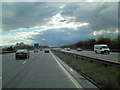
Surrey Heath : The M3
The M3 with a big sign with directions to Southampton, Basingstoke, Guildford, Farnham, Camberley, Farnborough and Aldershot.
Image: © Lewis Clarke
Taken: 6 Jul 2014
0.04 miles
2
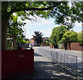
James Road
View into James Road from the traffic lights at the junction with Frimley Road. James Road runs parallel to the M3 and just to the north of it.
Image: © Euchiasmus
Taken: 8 Aug 2007
0.04 miles
3

M3 westbound
Junction 4 for the A331 ahead.
Image: © Robin Webster
Taken: 16 Dec 2017
0.04 miles
5

Surrey Heath : M3 Motorway
The M3 Motorway between Junction 3 (Bagshot Interchange) and Junction 4 (Frimley Interchange).
Image: © Lewis Clarke
Taken: 19 Mar 2019
0.08 miles
6
Albany Park Industrial Estate
Albany Park Industrial Estate has numerous industrial, business and office units used by companies such as Sun Microsystems, Krispy Kreme Doughnuts, Amazon Filters UK, Cablenet Trackmaster Ltd and Javelin Plastics. The M3 motorway runs along the northern edge of the estate - a blue lorry on the motorway can just be seen on this photograph above the more distant building to the right.
Image: © Euchiasmus
Taken: 31 Jul 2007
0.09 miles
7
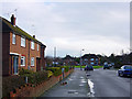
Bain Avenue
Bain Avenue is a residential road in the area west of the Frimley Road and north of the M3 motorway. This photograph looks towards the triangular area of grass which can be seen at the centre of the satellite image at http://www.flashearth.com/?lat=51.319075&lon=-0.754982&z=19.1&r=0&src=msl and the M3 motorway is on a slight embankment on the far horizon. The orange and white plastic bags that can just be seen on the pavement are sorted household waste awaiting collection for recycling.
Image: © Euchiasmus
Taken: 7 Jan 2008
0.09 miles
8
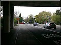
Frimley Road, under the M3 Bridge, Camberley
Image: © Rich Tea
Taken: 21 Apr 2016
0.11 miles
9

M3 bridge over the Frimley Road
The M3 motorway bridge over the B3411 Frimley Road can be seen here from the north. The bus is travelling towards Camberley. I tried to combine in this photo the fast heavy traffic on the motorway, the relatively gentle pace of a suburban bus service and a sobering reminder of the dangers of road transport.
Image: © Euchiasmus
Taken: 8 Aug 2007
0.11 miles
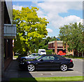
10

Matalan store, Frimley Road, Camberley
The building was previously home to the Focus DIY store, see this picture from 2007 Image
Image: © Rich Tea
Taken: 21 Apr 2016
0.12 miles