IMAGES TAKEN NEAR TO
Greenlands Road, CAMBERLEY, GU15 2RT
Introduction
This page details the photographs taken nearby to Greenlands Road, GU15 2RT by members of the Geograph project.
The Geograph project started in 2005 with the aim of publishing, organising and preserving representative images for every square kilometre of Great Britain, Ireland and the Isle of Man.

There are currently over 7.5m images from over14,400 individuals and you can help contribute to the project by visiting https://www.geograph.org.uk
Image Map
Images are licensed for reuse under creativecommons.org/licenses/by-sa/2.0
Notes
- Clicking on the map will re-center to the selected point.
- The higher the marker number, the further away the image location is from the centre of the postcode.
Image Listing (49 Images Found)
Images are licensed for reuse under creativecommons.org/licenses/by-sa/2.0
Image
Details
Distance
2
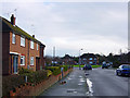
Bain Avenue
Bain Avenue is a residential road in the area west of the Frimley Road and north of the M3 motorway. This photograph looks towards the triangular area of grass which can be seen at the centre of the satellite image at http://www.flashearth.com/?lat=51.319075&lon=-0.754982&z=19.1&r=0&src=msl and the M3 motorway is on a slight embankment on the far horizon. The orange and white plastic bags that can just be seen on the pavement are sorted household waste awaiting collection for recycling.
Image: © Euchiasmus
Taken: 7 Jan 2008
0.09 miles
3
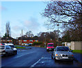
Junction of Bain Avenue and Westfield Road
Bain Avenue curves to the left in the distance, and Westfield Road branches off to the right just in front of the houses. This is a residential area north of the M3 motorway and west of the B3411 Frimley Road. (Vehicle registration plates have been obscured out of consideration for owners' privacy).
Image: © Euchiasmus
Taken: 7 Jan 2008
0.11 miles
6
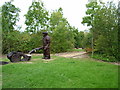
Watchmoor Reserve
A sculpture in Watchmoor Reserve, a small wildlife area with new trees, ponds, sculptures and an outdoor classroom
Image: © Jonathan Dew
Taken: 12 Sep 2004
0.15 miles
7
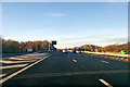
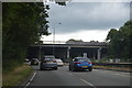
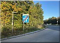
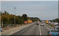
M3 westbound
The junction 4 slip road to the A331 is on the left.
Image: © Robin Webster
Taken: 16 Dec 2017
0.15 miles
8
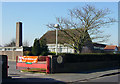
Bristow Infant & Nursery School
This school is southwest of James Road in the middle of this residential area north of Frimley and just north of the M3 motorway.
Image: © Euchiasmus
Taken: 18 Feb 2008
0.15 miles