IMAGES TAKEN NEAR TO
Martindale Avenue, CAMBERLEY, GU15 1BD
Introduction
This page details the photographs taken nearby to Martindale Avenue, GU15 1BD by members of the Geograph project.
The Geograph project started in 2005 with the aim of publishing, organising and preserving representative images for every square kilometre of Great Britain, Ireland and the Isle of Man.

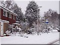
There are currently over 7.5m images from over14,400 individuals and you can help contribute to the project by visiting https://www.geograph.org.uk
Image Map
Images are licensed for reuse under creativecommons.org/licenses/by-sa/2.0
Notes
- Clicking on the map will re-center to the selected point.
- The higher the marker number, the further away the image location is from the centre of the postcode.
Image Listing (46 Images Found)
Images are licensed for reuse under creativecommons.org/licenses/by-sa/2.0
Image
Details
Distance
1
Navigating northwards up the Basher (26)
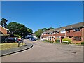
Houses in Coniston Close
Image: © Basher Eyre
Taken: 5 Jun 2023
0.06 miles
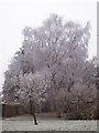
3
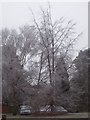
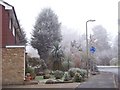
Frozen Tree 2
Frozen tree as the result of the severe frost on the 10th Jan 2009
Image: © Len Williams
Taken: 10 Jan 2009
0.14 miles
4
Cumberland Road, Frimley
In the Heatherside neighbourhood.
Image: © Robin Webster
Taken: 9 Jun 2019
0.14 miles
5
Global Warming ?
The fall of snow on the 2nd Feb. 2009 turned the semi-tropical garden into an arctic wilderness.
Image: © Len Williams
Taken: 2 Feb 2009
0.14 miles
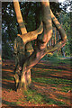
6
Frozen Tree 3
Frozen tree as the result of the severe frost on the 10th Jan 2009
Image: © Len Williams
Taken: 10 Jan 2009
0.15 miles
7
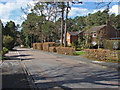
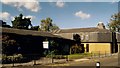
Goldney Road, Camberley
A residential road in the Heatherside estate in Camberley. Most of this area was developed in the 1970s.
Image: © Alan Hunt
Taken: 19 Apr 2013
0.16 miles
9
Jack Frost strikes again !
The semi-tropical plants in the garden have been stunned by the severe frost.
Image: © Len Williams
Taken: 10 Jan 2009
0.16 miles
10
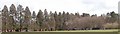
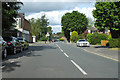
Wellingtonia Pine, avenue 2
An avenue of Wellingtonia pines stretched from the Upper Chobham Road to Brookwood House, (now the Ridgewood Centre). This photo shows the avenue as seen from the corner of Cumberland Road and Martindale Avenue. For a view from within the avenue refer to picture Image
Image: © Len Williams
Taken: 30 Mar 2008
0.17 miles