IMAGES TAKEN NEAR TO
Eagle Road, GUILDFORD, GU1 4HX
Introduction
This page details the photographs taken nearby to Eagle Road, GU1 4HX by members of the Geograph project.
The Geograph project started in 2005 with the aim of publishing, organising and preserving representative images for every square kilometre of Great Britain, Ireland and the Isle of Man.

There are currently over 7.5m images from over14,400 individuals and you can help contribute to the project by visiting https://www.geograph.org.uk
Image Map
Images are licensed for reuse under creativecommons.org/licenses/by-sa/2.0
Notes
- Clicking on the map will re-center to the selected point.
- The higher the marker number, the further away the image location is from the centre of the postcode.
Image Listing (293 Images Found)
Images are licensed for reuse under creativecommons.org/licenses/by-sa/2.0
Image
Details
Distance
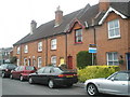
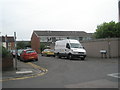
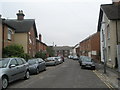
2
Looking from Onslow Road back down Falcon Road
Image: © Basher Eyre
Taken: 10 Jul 2009
0.02 miles
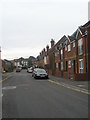
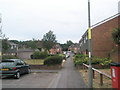
8
Looking from Onslow Road towards Queens Road
Image: © Basher Eyre
Taken: 10 Jul 2009
0.05 miles
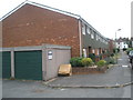
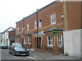
10
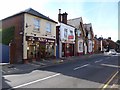
Stoke Road, Guildford
Niki's Barbers, Fish and Chips (once the Rifleman pub) and the Prince Albert.
Image: © David960
Taken: 9 Aug 2014
0.05 miles