IMAGES TAKEN NEAR TO
Thyme Court, FARNBOROUGH, GU14 9XT
Introduction
This page details the photographs taken nearby to Thyme Court, GU14 9XT by members of the Geograph project.
The Geograph project started in 2005 with the aim of publishing, organising and preserving representative images for every square kilometre of Great Britain, Ireland and the Isle of Man.

There are currently over 7.5m images from over14,400 individuals and you can help contribute to the project by visiting https://www.geograph.org.uk
Image Map (Loading...)


Getting Data...Please wait
Leaflet Map data © OpenStreetMap
Images are licensed for reuse under creativecommons.org/licenses/by-sa/2.0
Notes
- Clicking on the map will re-center to the selected point.
- The higher the marker number, the further away the image location is from the centre of the postcode.
Image Listing (50 Images Found)
Images are licensed for reuse under creativecommons.org/licenses/by-sa/2.0
Image
Details
Distance
1

Kenilworth Road
Kenilworth Road at midnight during lightning storm in September 2005.
Image: © Anton Robinson
Taken: 4 Sep 2005
0.15 miles
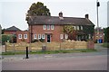
3

Does it need a SORN?
SORN - Statutory Off Road Notification.
Image: © Fernweh
Taken: 3 Nov 2015
0.17 miles
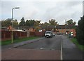
6
View down Kenilworth Road
The dark tall fencing marks the location of former 'semis' Image which have just been demolished. Scaffolding shows that new builds are on their way.
Image: © Fernweh
Taken: 3 Nov 2015
0.17 miles
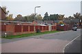
7
Houses in Whetstone Road
Note the CCTV pole, keeping an eye on the shops Image, across the road from here.
Image: © Fernweh
Taken: 3 Nov 2015
0.18 miles