IMAGES TAKEN NEAR TO
Fleet Road, FARNBOROUGH, GU14 9RE
Introduction
This page details the photographs taken nearby to Fleet Road, GU14 9RE by members of the Geograph project.
The Geograph project started in 2005 with the aim of publishing, organising and preserving representative images for every square kilometre of Great Britain, Ireland and the Isle of Man.

There are currently over 7.5m images from over14,400 individuals and you can help contribute to the project by visiting https://www.geograph.org.uk
Image Map (Loading...)


Getting Data...Please wait
Leaflet Map data © OpenStreetMap
Images are licensed for reuse under creativecommons.org/licenses/by-sa/2.0
Notes
- Clicking on the map will re-center to the selected point.
- The higher the marker number, the further away the image location is from the centre of the postcode.
Image Listing (70 Images Found)
Images are licensed for reuse under creativecommons.org/licenses/by-sa/2.0
Image
Details
Distance
4
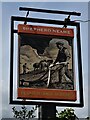
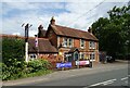
Sign for the Plough and Horses, Cove
See Image] for context.
Image: © JThomas
Taken: 27 Jul 2022
0.07 miles
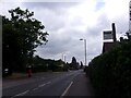
5
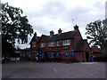
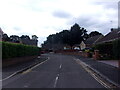
The Plough and Horses, Cove
On Fleet Road.
See Image] for sign.
Image: © JThomas
Taken: 27 Jul 2022
0.08 miles
7
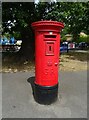
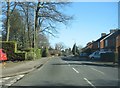
George V postbox on Fleet Road, Cove
Postbox No. GU14 88.
Image: © JThomas
Taken: 27 Jul 2022
0.09 miles
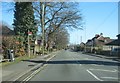
10
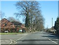
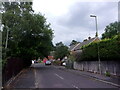
Looking from Fleet Road into Woodcot Gardens
Image: © Basher Eyre
Taken: 20 Jul 2022
0.10 miles