IMAGES TAKEN NEAR TO
Perring Avenue, FARNBOROUGH, GU14 9DA
Introduction
This page details the photographs taken nearby to Perring Avenue, GU14 9DA by members of the Geograph project.
The Geograph project started in 2005 with the aim of publishing, organising and preserving representative images for every square kilometre of Great Britain, Ireland and the Isle of Man.

There are currently over 7.5m images from over14,400 individuals and you can help contribute to the project by visiting https://www.geograph.org.uk
Image Map
Images are licensed for reuse under creativecommons.org/licenses/by-sa/2.0
Notes
- Clicking on the map will re-center to the selected point.
- The higher the marker number, the further away the image location is from the centre of the postcode.
Image Listing (373 Images Found)
Images are licensed for reuse under creativecommons.org/licenses/by-sa/2.0
Image
Details
Distance
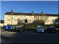
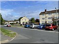
1

New style & old style housing
The new builds,at the far end, are in Elm Tree Walk, the old block of flats has Perring Avenue as an address.
Image: © Fernweh
Taken: 23 Sep 2014
0.01 miles
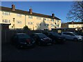
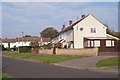
8
Flats in Perring Avenue
Viewed from Elm Tree Walk.
Image: © Fernweh
Taken: 4 Jun 2003
0.03 miles