IMAGES TAKEN NEAR TO
Ley Road, FARNBOROUGH, GU14 8ED
Introduction
This page details the photographs taken nearby to Ley Road, GU14 8ED by members of the Geograph project.
The Geograph project started in 2005 with the aim of publishing, organising and preserving representative images for every square kilometre of Great Britain, Ireland and the Isle of Man.

There are currently over 7.5m images from over14,400 individuals and you can help contribute to the project by visiting https://www.geograph.org.uk
Image Map (Loading...)


Getting Data...Please wait
Leaflet Map data © OpenStreetMap
Images are licensed for reuse under creativecommons.org/licenses/by-sa/2.0
Notes
- Clicking on the map will re-center to the selected point.
- The higher the marker number, the further away the image location is from the centre of the postcode.
Image Listing (543 Images Found)
Images are licensed for reuse under creativecommons.org/licenses/by-sa/2.0
Image
Details
Distance
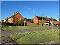
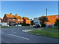
1
Early morning light - Ley Road
The house on the right is called 'The Corner House'!
Image: © Fernweh
Taken: 29 Sep 2015
0.00 miles

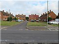
6
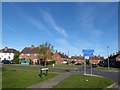
2016: a year on Geograph (Day 119)
Looking from Lye Copse Avenue, across Lye Road and into North Close
Image: © Basher Eyre
Taken: 28 Apr 2016
0.02 miles
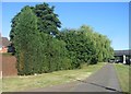
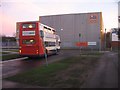
7

Multiple cycle routes
There are very few cyclists in the area, I pass the same four everyday enroute to work.
Image: © Fernweh
Taken: 6 Oct 2022
0.02 miles