IMAGES TAKEN NEAR TO
Minster Close, FARNBOROUGH, GU14 6UB
Introduction
This page details the photographs taken nearby to Minster Close, GU14 6UB by members of the Geograph project.
The Geograph project started in 2005 with the aim of publishing, organising and preserving representative images for every square kilometre of Great Britain, Ireland and the Isle of Man.

There are currently over 7.5m images from over14,400 individuals and you can help contribute to the project by visiting https://www.geograph.org.uk
Image Map
Images are licensed for reuse under creativecommons.org/licenses/by-sa/2.0
Notes
- Clicking on the map will re-center to the selected point.
- The higher the marker number, the further away the image location is from the centre of the postcode.
Image Listing (90 Images Found)
Images are licensed for reuse under creativecommons.org/licenses/by-sa/2.0
Image
Details
Distance
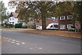
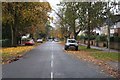
1
Westward view along Reading Road
Taken from the road island in front of Silesian College.
Image: © Fernweh
Taken: 1 Oct 2015
0.10 miles
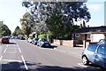
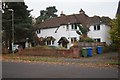
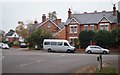
2
View around Church Circle
Viewed from Oxford Road.
Image: © Fernweh
Taken: 4 Nov 2015
0.10 miles
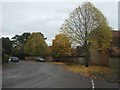
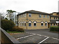
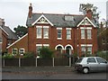
4
Old block - Church Circle
Facing Oxford Road.
Image: © Fernweh
Taken: 4 Nov 2015
0.11 miles
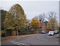
6
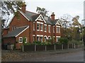
Salesian College
An independent Catholic grammar school.
Image: © don cload
Taken: 7 Nov 2012
0.12 miles
9
Old block - Church Circle
Facing Church Road East.
Image: © Fernweh
Taken: 4 Nov 2015
0.12 miles