
IMAGES TAKEN NEAR TO
Fowler Road, FARNBOROUGH, GU14 0BN
Introduction
This page details the photographs taken nearby to Fowler Road, GU14 0BN by members of the Geograph project.
The Geograph project started in 2005 with the aim of publishing, organising and preserving representative images for every square kilometre of Great Britain, Ireland and the Isle of Man.

There are currently over 7.5m images from over14,400 individuals and you can help contribute to the project by visiting https://www.geograph.org.uk
Image Map
Images are licensed for reuse under creativecommons.org/licenses/by-sa/2.0
Notes
- Clicking on the map will re-center to the selected point.
- The higher the marker number, the further away the image location is from the centre of the postcode.
Image Listing (18 Images Found)
Images are licensed for reuse under creativecommons.org/licenses/by-sa/2.0
Image
Details
Distance
1
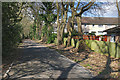
Hazel Avenue, Farnborough
Only the north and south ends of Hazel Avenue are accessible to vehicles, this centre section if closed to traffic.
Image: © Alan Hunt
Taken: 5 Apr 2016
0.17 miles
2
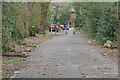
Hazel Avenue, Farnborough
The southern end of the "closed" stretch of Hazel Avenue in Farnborough.
Image: © Alan Hunt
Taken: 5 Apr 2016
0.18 miles
3
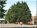
Farnborough Sorting Office
The Farnborough Sorting Office is situated at the end of Invincible Road.
Image: © don cload
Taken: 5 Jun 2010
0.18 miles
4
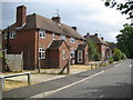
Cove: Wood Lane
There are eleven of these pairs of semidetached social housing blocks in Wood Lane, all currently unoccupied and being refurbished by, I think, Rushmoor Borough Council and the Sentinel Housing Group. As can be seen by the arrow in the road, far right, Wood Lane is a one way street.
Image: © Nigel Cox
Taken: 3 Jul 2009
0.18 miles
5
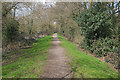
Path beside the Cove Brook
The path running alongside the Cove Brook in Southwood Meadows, Farnborough.
Image: © Alan Hunt
Taken: 5 Apr 2016
0.19 miles
6
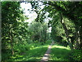
Path by Hazel Avenue
This path runs parallel to Hazel Avenue between the avenue and Cove Brook.
Image: © don cload
Taken: 5 Jun 2010
0.19 miles
7
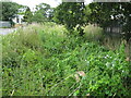
Cove: Merrow Brook
Hidden in the dip beneath all that lush vegetation is Merrow Brook. Eelmoor Road is visible to the left, named after a former farm in the area.
Image: © Nigel Cox
Taken: 3 Jul 2009
0.20 miles
8
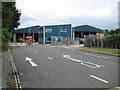
Cove: Rushmoor Waste Transfer Station
Rushmoor Waste Transfer Station is at the eastern end of Eelmoor Road and was opened in 1997. The household waste recycling centre is to the right, the Q painted on the road indicating the waiting lane so that domestic users do not obstruct lorry access to the transfer station in the left hand lane.
Image: © Nigel Cox
Taken: 3 Jul 2009
0.20 miles
9
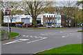
Arrow Road, Farnborough
The junction of Arrow Road with Eelmoor Road in the industrial area north of the airfield.
Image: © Alan Hunt
Taken: 16 Nov 2015
0.20 miles
10
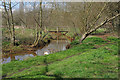
Cove Brook, Farnborough
A footbridge over the Cove Brook passing through the Southwood Meadows.
Image: © Alan Hunt
Taken: 5 Apr 2016
0.21 miles