
IMAGES TAKEN NEAR TO
Clandon Road, GU1 2WP
Introduction
This page details the photographs taken nearby to Clandon Road, GU1 2WP by members of the Geograph project.
The Geograph project started in 2005 with the aim of publishing, organising and preserving representative images for every square kilometre of Great Britain, Ireland and the Isle of Man.

There are currently over 7.5m images from over14,400 individuals and you can help contribute to the project by visiting https://www.geograph.org.uk
Image Map
Images are licensed for reuse under creativecommons.org/licenses/by-sa/2.0
Notes
- Clicking on the map will re-center to the selected point.
- The higher the marker number, the further away the image location is from the centre of the postcode.
Image Listing (194 Images Found)
Images are licensed for reuse under creativecommons.org/licenses/by-sa/2.0
Image
Details
Distance
1
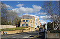
Clandon Road, Guildford
A more recent development in an area of mainly Victorian housing.
Image: © Des Blenkinsopp
Taken: 14 Mar 2023
0.01 miles
2
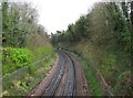
Railway looking east from London Road Bridge, Guildford
Like the majority of electrified railway lines in the south and southeast of England, this one uses the third rail system.
Image: © P L Chadwick
Taken: 4 Apr 2012
0.02 miles
3
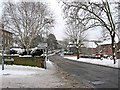
Corner of Clandon Road and London Road (A3100)
Looking in the direction of Guildford town centre.
Image: © L S Wilson
Taken: 3 Dec 2010
0.04 miles
4
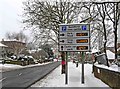
Car parking sign in London Road (A3100)
A useful sign for motorists, near London Road Guildford Railway Station. The road on the left is Clandon Road.
Image: © L S Wilson
Taken: 3 Dec 2010
0.04 miles
5
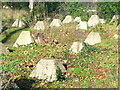
Dragon's Teeth
WW2 anti-tank defences (1942) beside Guildford's London Road railway station.
www.guildford.gov.uk
Image: © Colin Smith
Taken: 9 Dec 2011
0.04 miles
6
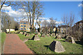
Anti Tank Blocks near the Station
At the end of the car park at London Road Station a short path goes up to London Road.
The concrete blocks date from WW2.
Image: © Des Blenkinsopp
Taken: 14 Mar 2023
0.05 miles
7
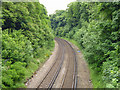
Railway east of London Road (Guildford) station
The way to Waterloo via Cobham or Epsom.
Image: © Robin Webster
Taken: 10 Jun 2012
0.05 miles
8
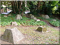
"Dragon's Teeth"
These former WW2 tank obstructions are by the road bridge above Guildford's London Road station. Guildford is a gap town, sited where the Wey flows through the North Downs and was to be a defensive point in the event of a German invasion in 1940. London Road is visible through the trees.
Image: © Colin Smith
Taken: 13 Sep 2006
0.05 miles
9
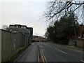
Looking from London Road into Nightingale Road
Image: © Basher Eyre
Taken: 11 Dec 2021
0.05 miles
10
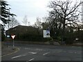
Looking from Nightingale Road onto the A3100
Image: © Basher Eyre
Taken: 11 Dec 2021
0.05 miles