
IMAGES TAKEN NEAR TO
Hillier Road, GUILDFORD, GU1 2JG
Introduction
This page details the photographs taken nearby to Hillier Road, GU1 2JG by members of the Geograph project.
The Geograph project started in 2005 with the aim of publishing, organising and preserving representative images for every square kilometre of Great Britain, Ireland and the Isle of Man.

There are currently over 7.5m images from over14,400 individuals and you can help contribute to the project by visiting https://www.geograph.org.uk
Image Map
Images are licensed for reuse under creativecommons.org/licenses/by-sa/2.0
Notes
- Clicking on the map will re-center to the selected point.
- The higher the marker number, the further away the image location is from the centre of the postcode.
Image Listing (52 Images Found)
Images are licensed for reuse under creativecommons.org/licenses/by-sa/2.0
Image
Details
Distance
1
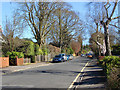
Hillier Road, Guildford
The road itself dates back to late Edwardian times but many of the houses were built at a later date.
Image: © Alan Hunt
Taken: 20 Apr 2013
0.06 miles
2
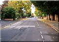
Pit Farm Road
Another wide and long road of spacious houses, leading off Epsom Road.
Image: © P L Chadwick
Taken: 23 Oct 2009
0.07 miles
3
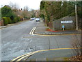
The junction of Pit Farm Road and Cranley Close
Image: © Shazz
Taken: 18 Feb 2012
0.08 miles
4
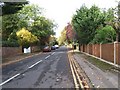
Hillier Road
One of the many residential roads of large houses, off Epsom Road.
Image: © P L Chadwick
Taken: 23 Oct 2009
0.08 miles
5
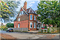
12 Pit Farm Road
Large late 19th Century house in Pit Farm Road, marked on the 1896 25 inch map. Named as Grove End House, it is now subdivided into apartments.
Image: © Ian Capper
Taken: 24 Oct 2023
0.09 miles
6
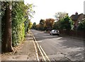
Pit Farm Road
Pit Farm Road is typical of this area of Guildford, with large houses, mainly set back from the road. Image
Image: © P L Chadwick
Taken: 23 Oct 2009
0.09 miles
7
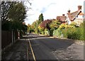
Pit Farm Road
There is no Pit Farm around here now - just this road which bears its name, and Pit Farm Tennis Club. But the latter's club house only dates from 1991. At the end of Pit Farm Road it forms a T junction with Cranley Road. Image
Image: © P L Chadwick
Taken: 23 Oct 2009
0.09 miles
8
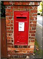
George V wall mounted postbox, Pit Farm Road
This is my 2000th submission to GeoGraph, and it's nothing more exciting than this wall mounted post box on the corner of Pit Farm Road and Cranley Road. Postboxes dating from the reign of George V do not contain the roman numeral V, probably because the Post Office weren't expecting a George VI, but history decreed otherwise.
Image: © P L Chadwick
Taken: 23 Oct 2009
0.09 miles
9
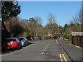
Cranley Close
A residential road off Pit Farm Road.The road layout in this part of Guildford dates from late Edwardian times but many of the houses came later. Pit Farm was sited between Cranley Close and Cranley Road.
Image: © Alan Hunt
Taken: 20 Apr 2013
0.09 miles
10
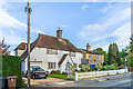
18 & 16 Pit Farm Road
Houses in Pit Farm Road. No 18 dates from the early 20th Century and no 16, on the right, named Pit Farm Cottage, is presumably older, Pit Farm itself long predating the current road.
Image: © Ian Capper
Taken: 24 Oct 2023
0.09 miles