
IMAGES TAKEN NEAR TO
Grange Road, ALDERSHOT, GU12 6ER
Introduction
This page details the photographs taken nearby to Grange Road, GU12 6ER by members of the Geograph project.
The Geograph project started in 2005 with the aim of publishing, organising and preserving representative images for every square kilometre of Great Britain, Ireland and the Isle of Man.

There are currently over 7.5m images from over14,400 individuals and you can help contribute to the project by visiting https://www.geograph.org.uk
Image Map
Images are licensed for reuse under creativecommons.org/licenses/by-sa/2.0
Notes
- Clicking on the map will re-center to the selected point.
- The higher the marker number, the further away the image location is from the centre of the postcode.
Image Listing (54 Images Found)
Images are licensed for reuse under creativecommons.org/licenses/by-sa/2.0
Image
Details
Distance
1
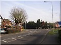
Road junction, Ash Street / Grange Road, Ash, Surrey
It is the pollarded tree (elm?) that makes this scene. The road curving to the left is Ash Church Road.
Image: © Humphrey Bolton
Taken: 24 Jan 2006
0.02 miles
2
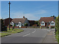
South Lane, Ash
The junction of South Lane with Grange Road on the right.
Image: © Alan Hunt
Taken: 27 May 2013
0.02 miles
3
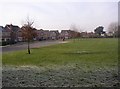
Recreation ground and houses off Grange Road, Ash, Surrey
Taken at midday, but there is still frost on the grass in the shade. Looking westwards.
Image: © Humphrey Bolton
Taken: 24 Jan 2006
0.05 miles
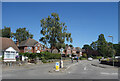
5
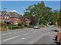
Grange Road, Ash
Looking east along Grange Road from the junction with South lane.
Image: © Alan Hunt
Taken: 27 May 2013
0.06 miles
6
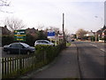
Estate agent's signs, Ash Street, Ash, Surrey
There is a block of flats to the left, and a long row of estate agent's signs along the roadside. This is looking westwards from near to the Grange Road junction.
Image: © Humphrey Bolton
Taken: 24 Jan 2006
0.08 miles
7
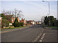
Ash Street, Ash, Surrey
Looking eastwards. Here is a rare quiet period on this busy main road (A323). In the 19C, there were houses here and there along the road, some of them dating from the 16C and 17C. Now all the gaps are filled and it is solid suburbia.
Image: © Humphrey Bolton
Taken: 24 Jan 2006
0.08 miles
8
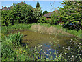
Pond, South Lane
The small pond on the corner between South Lane and Parish Close. This appears to be a recent addition as there is no record of this pond on the pre-1970s maps.
Image: © Alan Hunt
Taken: 27 May 2013
0.08 miles
9
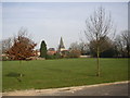
Recreation ground off Grange Road, Ash, Surrey
This is the view northwards, with Ash Church in the background.
Image: © Humphrey Bolton
Taken: 24 Jan 2006
0.08 miles
10
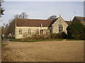
Holy Angels RC Church, Ash, Surrey
When taking this photo I assumed that the building was a former church school, being opposite a modern school and near to the church, but the excellent village guide leaflet 'A Trail through Time' informs me that it is the Roman Catholic Church, built in 1934. This is the rear view, from the car park (chosen because the sun was on it!)
Image: © Humphrey Bolton
Taken: 24 Jan 2006
0.08 miles