IMAGES TAKEN NEAR TO
Cordelia Gardens, ALDERSHOT, GU12 5QP
Introduction
This page details the photographs taken nearby to Cordelia Gardens, GU12 5QP by members of the Geograph project.
The Geograph project started in 2005 with the aim of publishing, organising and preserving representative images for every square kilometre of Great Britain, Ireland and the Isle of Man.

There are currently over 7.5m images from over14,400 individuals and you can help contribute to the project by visiting https://www.geograph.org.uk
Image Map (Loading...)


Getting Data...Please wait
Leaflet Map data © OpenStreetMap
Images are licensed for reuse under creativecommons.org/licenses/by-sa/2.0
Notes
- Clicking on the map will re-center to the selected point.
- The higher the marker number, the further away the image location is from the centre of the postcode.
Image Listing (51 Images Found)
Images are licensed for reuse under creativecommons.org/licenses/by-sa/2.0
Image
Details
Distance
1
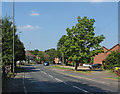
Stratford Road, Ash Vale
The B3165, Stratford Road, a residential road in Ash Vale.
Image: © Alan Hunt
Taken: 6 Jul 2013
0.05 miles
2
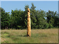
Totem Pole
A modern take on a totem pole in the access land off Stratford Road
Image: © Alan Hunt
Taken: 6 Jul 2013
0.07 miles
3
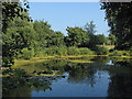
Pond near Grove Farm
A pond in the access land near Grove Farm.
Image: © Alan Hunt
Taken: 6 Jul 2013
0.10 miles
4
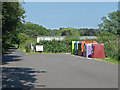
Recycling bins, Carrington recreation ground
Recycling bins in the car park of the Carrington recreation ground off Lysons Avenue.
Image: © Alan Hunt
Taken: 6 Jul 2013
0.11 miles
5
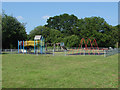
Carrington recreation ground play area
The children's play area in the Carrington recreation ground
Image: © Alan Hunt
Taken: 6 Jul 2013
0.13 miles
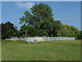
6
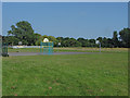
Basketball court, Carrington recreation ground
A basketball court in the Carrington recreation ground off Lysons Avenue.
Image: © Alan Hunt
Taken: 6 Jul 2013
0.14 miles
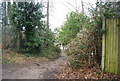
7
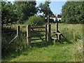
Stile near Grove Farm
A stile in the access land off Stratford Road with the Grove Farm mobile home park in the background.
Image: © Alan Hunt
Taken: 6 Jul 2013
0.14 miles
8
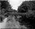
Deedman's Footbridge, Basingstoke Canal
This footbridge is private, and is not even marked on some maps.
Image: © Dr Neil Clifton
Taken: 31 Aug 1980
0.15 miles
9
Fenced enclosure, Carrington recreation ground
Sheds in a fenced enclosure on the edge of the Carrington recreation ground off Lysons Avenue.
Image: © Alan Hunt
Taken: 6 Jul 2013
0.15 miles