IMAGES TAKEN NEAR TO
Stanhope Mews, GU11 4FG
Introduction
This page details the photographs taken nearby to Stanhope Mews, GU11 4FG by members of the Geograph project.
The Geograph project started in 2005 with the aim of publishing, organising and preserving representative images for every square kilometre of Great Britain, Ireland and the Isle of Man.

There are currently over 7.5m images from over14,400 individuals and you can help contribute to the project by visiting https://www.geograph.org.uk
Image Map
Images are licensed for reuse under creativecommons.org/licenses/by-sa/2.0
Notes
- Clicking on the map will re-center to the selected point.
- The higher the marker number, the further away the image location is from the centre of the postcode.
Image Listing (9 Images Found)
Images are licensed for reuse under creativecommons.org/licenses/by-sa/2.0
Image
Details
Distance
1
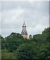
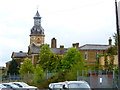
View of former Cambridge Military Hospital, Aldershot
Just the top of the picturesque clock tower (built 1875-79).
The hospital closed in 1996.
Image: © Stephen Richards
Taken: 10 Jul 2012
0.08 miles
3
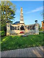
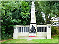
RAMC war memorial, Gun Hill
For more about this memorial see https://en.wikipedia.org/wiki/RAMC_Memorial,_Aldershot
Image: © Basher Eyre
Taken: 10 May 2024
0.22 miles
6
Laws Terrace
Modern housing in Aldershot.
Image: © James Emmans
Taken: 13 Dec 2021
0.23 miles
7
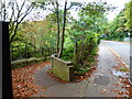
Steps leading down from Gun Hill
The dwellings are in Falaise Close.
Image: © Shazz
Taken: 26 Sep 2014
0.23 miles
8
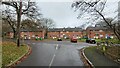
Terrace housing in Falaise Close
Residential road in Aldershot town centre.
Named after a successful battle buring the Battle of Normandy in WWII.
https://en.wikipedia.org/wiki/Falaise_pocket
Image: © James Emmans
Taken: 13 Dec 2021
0.23 miles