
IMAGES TAKEN NEAR TO
Charteris Close, ALDERSHOT, GU11 4DY
Introduction
This page details the photographs taken nearby to Charteris Close, GU11 4DY by members of the Geograph project.
The Geograph project started in 2005 with the aim of publishing, organising and preserving representative images for every square kilometre of Great Britain, Ireland and the Isle of Man.

There are currently over 7.5m images from over14,400 individuals and you can help contribute to the project by visiting https://www.geograph.org.uk
Image Map
Images are licensed for reuse under creativecommons.org/licenses/by-sa/2.0
Notes
- Clicking on the map will re-center to the selected point.
- The higher the marker number, the further away the image location is from the centre of the postcode.
Image Listing (14 Images Found)
Images are licensed for reuse under creativecommons.org/licenses/by-sa/2.0
Image
Details
Distance
1
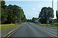
A325 Farnborough Road
Towards Farnborough, with an old military site being redeveloped on the right.
Image: © Robin Webster
Taken: 11 Aug 2019
0.05 miles
2
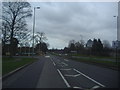
Turnoff for Fleet Road off Farnborough Road
The A323 meets the A30 at Hartley Wintney beyond Fleet
Image: © David Howard
Taken: 18 Mar 2012
0.08 miles
3
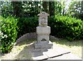
Memorial drinking fountain
The inscription reads "Near this spot on the 30th May 1910 Capt Charles Claudius de la Poer Beresford Royal Engineers was killed in a brave attempt to stop a runaway horse". (see http://www.geograph.org.uk/photo/4080699 for detail).
The fountain was thought to be erected about 1934 as it does nor appear on any O.S. maps before this date. See http://list.english-heritage.org.uk/resultsingle.aspx?uid=1393805 for more details.
Image: © Bikeboy
Taken: 13 Jul 2014
0.08 miles
4
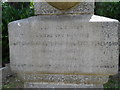
Detail of memorial drinking fountain
The inscription is very worn but it reads "Near this spot on the 30th May 1910 Capt Charles Claudius de la Poer Beresford Royal Engineers was killed in a brave attempt to stop a runaway horse". See http://www.geograph.org.uk/photo/4080695 for full view.
Image: © Bikeboy
Taken: 13 Jul 2014
0.08 miles
5
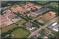
Aldershot Camp: some changes afoot (aerial 2016)
A comparison with the Satellite View shows that this area, marked the "Montgomery Lines" has mostly been flattened or redeveloped.
The Army Cricket Ground can be seen in the top right corner.
Image: © Chris
Taken: 13 Jun 2016
0.11 miles
6
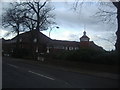
Potter's International Hotel, Fleet Road
Image: © David Howard
Taken: 18 Mar 2012
0.14 miles
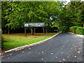
8
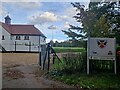
165,000 and counting
My first ever image was a cricket ground http://www.geograph.org.uk/569781 and I have taken many since to mark passing 5,000 or 10,000 multiples: http://www.geograph.org.uk/930308 http://www.geograph.org.uk/1750707 http://www.geograph.org.uk/2034398 http://www.geograph.org.uk/2658917 http://www.geograph.org.uk/2854165 http://www.geograph.org.uk/3037720 http://www.geograph.org.uk/3211614 http://www.geograph.org.uk/3582627 http://www.geograph.org.uk/4173703 http://www.geograph.org.uk/4583436 http://www.geograph.org.uk/4786478 http://www.geograph.org.uk/4987981 http://www.geograph.org.uk/5103404 http://www.geograph.org.uk/5279848 https://www.geograph.org.uk/photo/5475964 https://www.geograph.org.uk/photo/5954260 https://www.geograph.org.uk/photo/6278293 https://www.geograph.org.uk/photo/6616924
and https://www.geograph.org.uk/photo/7122013
This one is taken entering the Army Cricket Ground at Aldershot
Image: © Basher Eyre
Taken: 4 Oct 2023
0.20 miles
9
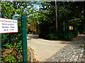
The gateway to the Prince Consort's Library
This is on Knollys Road.
Image: © Shazz
Taken: 26 Sep 2014
0.21 miles
10
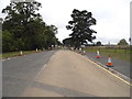
Camp entrance on Queen's Avenue, Aldershot
A lot of the camp looks very run down at the moment, this view is fairly typical
Image: © David Howard
Taken: 5 Sep 2016
0.23 miles