IMAGES TAKEN NEAR TO
Southmead Road, ALDERSHOT, GU11 3HF
Introduction
This page details the photographs taken nearby to Southmead Road, GU11 3HF by members of the Geograph project.
The Geograph project started in 2005 with the aim of publishing, organising and preserving representative images for every square kilometre of Great Britain, Ireland and the Isle of Man.

There are currently over 7.5m images from over14,400 individuals and you can help contribute to the project by visiting https://www.geograph.org.uk
Image Map
Images are licensed for reuse under creativecommons.org/licenses/by-sa/2.0
Notes
- Clicking on the map will re-center to the selected point.
- The higher the marker number, the further away the image location is from the centre of the postcode.
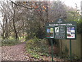
Image Listing (121 Images Found)
Images are licensed for reuse under creativecommons.org/licenses/by-sa/2.0
Image
Details
Distance
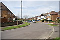
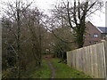
2
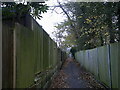
Path between Southmead Road and Centenary Lodge
Image: © Basher Eyre
Taken: 8 Dec 2022
0.04 miles
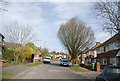
3
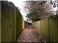
Path between Centenary Lodge and Highfields Gardens
Image: © Basher Eyre
Taken: 8 Dec 2022
0.04 miles
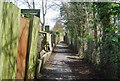

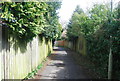
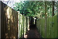
7
Boundary fence between Brickfields Park and Century Lodge
Image: © Basher Eyre
Taken: 8 Dec 2022
0.07 miles