
IMAGES TAKEN NEAR TO
Mill Lane, FARNHAM, GU10 5RR
Introduction
This page details the photographs taken nearby to Mill Lane, GU10 5RR by members of the Geograph project.
The Geograph project started in 2005 with the aim of publishing, organising and preserving representative images for every square kilometre of Great Britain, Ireland and the Isle of Man.

There are currently over 7.5m images from over14,400 individuals and you can help contribute to the project by visiting https://www.geograph.org.uk
Image Map
Images are licensed for reuse under creativecommons.org/licenses/by-sa/2.0
Notes
- Clicking on the map will re-center to the selected point.
- The higher the marker number, the further away the image location is from the centre of the postcode.
Image Listing (8 Images Found)
Images are licensed for reuse under creativecommons.org/licenses/by-sa/2.0
Image
Details
Distance
1

The A287 looking east from the end of Rye Common Lane
Image: © Shazz
Taken: 22 Dec 2013
0.04 miles

3

Looking north from the A287
The road ahead goes to an electricity substation
Image: © Shazz
Taken: 22 Dec 2013
0.13 miles
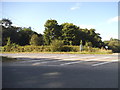
5
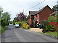
The old road at Mill Lane
The A287 now bypasses the hamlet.
Image: © Andrew Smith
Taken: 14 May 2006
0.18 miles
6

Looking west on the A287 at start of dual carriageway
On the far side of the road is a Nature Reserve.
Image: © Shazz
Taken: 22 Dec 2013
0.19 miles
7
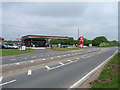
Petrol station at Mill Lane
Shows the now straight course of the A287. It formerly took a more southerly course down Bowling Alley to Erlands House.
Image: © Andrew Smith
Taken: 14 May 2006
0.25 miles
8
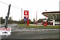
Mill Lane, Hampshire
The Murco petrol station on the A287 with the unusual petrol prices. Most garages charge xxx.9p per litre and this is the first we have seen for a long time charging xxx.5p per litre.
Image: © Brendan and Ruth McCartney
Taken: 27 Jan 2011
0.25 miles