IMAGES TAKEN NEAR TO
Hyde Lane, FARNHAM, GU10 5QW
Introduction
This page details the photographs taken nearby to Hyde Lane, GU10 5QW by members of the Geograph project.
The Geograph project started in 2005 with the aim of publishing, organising and preserving representative images for every square kilometre of Great Britain, Ireland and the Isle of Man.

There are currently over 7.5m images from over14,400 individuals and you can help contribute to the project by visiting https://www.geograph.org.uk
Image Map
Images are licensed for reuse under creativecommons.org/licenses/by-sa/2.0
Notes
- Clicking on the map will re-center to the selected point.
- The higher the marker number, the further away the image location is from the centre of the postcode.
Image Listing (11 Images Found)
Images are licensed for reuse under creativecommons.org/licenses/by-sa/2.0
Image
Details
Distance
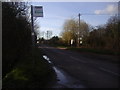
2
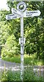
Old Direction Sign - Signpost by Hyde Lane, Bowling Alley
Annulus finial - 3 arms; Hampshire Parish halo by the UC road, in parish of Crondall (Hart District), Hyde Lane, Bowling Alley (lane), on grass island.
Surveyed
Milestone Society National ID: HA_SU7949
Image: © Milestone Society
Taken: Unknown
0.03 miles
3
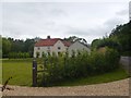
Royal Oak House, Bowling Alley, Crondall
The former Royal Oak pub, now a substantially extended house.
Image: © David960
Taken: 15 Jun 2014
0.08 miles
4
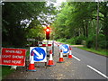
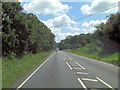
'Wait Here' - Mill Lane
The work was being done to the property bordering the road, not the road itself.
Image: © Mr Ignavy
Taken: 24 Jul 2010
0.10 miles
5
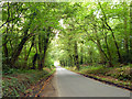
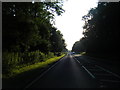
Hyde Lane
Hannam's Copse is to the left.
Image: © Robin Webster
Taken: 25 Sep 2014
0.11 miles
6
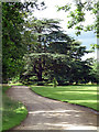
Cedar near Crondall
A stately Cedar of Lebanon in the grounds of Downsland House.
Image: © Stephen Richards
Taken: 11 Jul 2012
0.15 miles
7
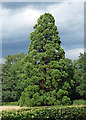
Wellingtonia near Crondall
The sort of exotic tree often found in the grounds of big houses.
Image: © Stephen Richards
Taken: 11 Jul 2012
0.21 miles
8
Bus stop on Bowling Alley
Bowling Alley is the name of the road and the village along it.
Image: © David Howard
Taken: 13 Mar 2011
0.22 miles