IMAGES TAKEN NEAR TO
Bowenhurst Lane, Mill Lane, FARNHAM, GU10 5HP
Introduction
This page details the photographs taken nearby to Bowenhurst Lane, Mill Lane, GU10 5HP by members of the Geograph project.
The Geograph project started in 2005 with the aim of publishing, organising and preserving representative images for every square kilometre of Great Britain, Ireland and the Isle of Man.

There are currently over 7.5m images from over14,400 individuals and you can help contribute to the project by visiting https://www.geograph.org.uk
Image Map
Images are licensed for reuse under creativecommons.org/licenses/by-sa/2.0
Notes
- Clicking on the map will re-center to the selected point.
- The higher the marker number, the further away the image location is from the centre of the postcode.
Image Listing (11 Images Found)
Images are licensed for reuse under creativecommons.org/licenses/by-sa/2.0
Image
Details
Distance
1
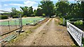
Bewenhurst Golf Centre Sign
The Bowenhurst Farm has diversified into business units and Golf.
Image: © James Emmans
Taken: 3 Jun 2022
0.03 miles
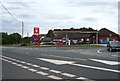
2
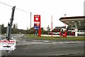
Mill Lane, Hampshire
The Murco petrol station on the A287 with the unusual petrol prices. Most garages charge xxx.9p per litre and this is the first we have seen for a long time charging xxx.5p per litre.
Image: © Brendan and Ruth McCartney
Taken: 27 Jan 2011
0.17 miles
3
BP station, Mill Lane
Completely demolished and rebuilt since http://www.geograph.org.uk/search.php?i=89071815 were taken.
Image: © Derek Harper
Taken: 2 Aug 2018
0.18 miles
4
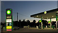
Murco filling station
Unfortunately the fuel prices didn't show in the picture. Older prices appear in Image
Image: © David Smith
Taken: 13 Apr 2012
0.19 miles
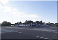
5
The Plough Garage
On the A287, Mill Lane.
Image: © Mr Ignavy
Taken: 24 Jul 2010
0.19 miles
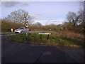
6
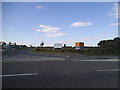
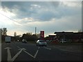
Junction on Farnham Road, Bowling Alley
Image: © David Howard
Taken: 14 Aug 2016
0.19 miles
7
Junction on Farnham Road, Bowling Alley
Image: © David Howard
Taken: 14 Aug 2016
0.20 miles
8

Looking towards the A287 from Bowenhurst Kennels and Cattery
Image: © Shazz
Taken: 22 Dec 2013
0.22 miles
9
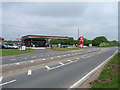
Petrol station at Mill Lane
Shows the now straight course of the A287. It formerly took a more southerly course down Bowling Alley to Erlands House.
Image: © Andrew Smith
Taken: 14 May 2006
0.22 miles
10
Bowling Alley at junction of Odiham Road
The road and village are both called Bowling Alley
Image: © David Howard
Taken: 13 Mar 2011
0.23 miles