
IMAGES TAKEN NEAR TO
Heath Lane, FARNHAM, GU10 5AL
Introduction
This page details the photographs taken nearby to Heath Lane, GU10 5AL by members of the Geograph project.
The Geograph project started in 2005 with the aim of publishing, organising and preserving representative images for every square kilometre of Great Britain, Ireland and the Isle of Man.

There are currently over 7.5m images from over14,400 individuals and you can help contribute to the project by visiting https://www.geograph.org.uk
Image Map
Images are licensed for reuse under creativecommons.org/licenses/by-sa/2.0
Notes
- Clicking on the map will re-center to the selected point.
- The higher the marker number, the further away the image location is from the centre of the postcode.
Image Listing (12 Images Found)
Images are licensed for reuse under creativecommons.org/licenses/by-sa/2.0
Image
Details
Distance
1
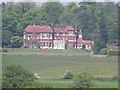
Ewshot Hall
Large country house near Dora's Green, seen from the St Swithun's Way.
Image: © Colin Smith
Taken: 23 May 2012
0.04 miles
2
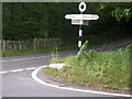
Ewshot
Junction of Green Lane and Heath Lane at SU815491.
Image: © Ben Gamble
Taken: 6 Jul 2005
0.13 miles
3
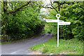
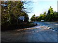
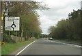
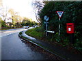
Signpost Heath Lane
At junction with Dora's Green Lane.
Image: © Oast House Archive
Taken: 19 May 2013
0.14 miles
9
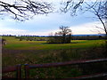
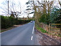
Stand of trees east of Dora's Green Lane
This penultimate picture of the day was a treat for me being the only one without building or roads. The North Downs provide the skyline.
Image: © Shazz
Taken: 7 Mar 2014
0.19 miles
10
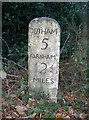
Old Milestone by the A287, Warren Corner, Crondall parish
Carved stone post by the A287, in parish of CRONDALL (HART District), Warren Corner, at the Ewshot cross roads, on right when climbing hill, on South side of road. Hook pillar, erected by Soberton Road in the 19th century.
Inscription reads:-
ODIHAM
5
FARNHAM
2½
MILES
Carved benchmark upside down on front face below inscription.
Milestone Society National ID: HA_ODFA05.
Image: © K Lawrence
Taken: 4 Jan 2003
0.20 miles