
IMAGES TAKEN NEAR TO
Odiham Road, FARNHAM, GU10 5AD
Introduction
This page details the photographs taken nearby to Odiham Road, GU10 5AD by members of the Geograph project.
The Geograph project started in 2005 with the aim of publishing, organising and preserving representative images for every square kilometre of Great Britain, Ireland and the Isle of Man.

There are currently over 7.5m images from over14,400 individuals and you can help contribute to the project by visiting https://www.geograph.org.uk
Image Map
Images are licensed for reuse under creativecommons.org/licenses/by-sa/2.0
Notes
- Clicking on the map will re-center to the selected point.
- The higher the marker number, the further away the image location is from the centre of the postcode.
Image Listing (12 Images Found)
Images are licensed for reuse under creativecommons.org/licenses/by-sa/2.0
Image
Details
Distance
1
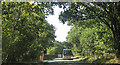
A287 near Ewshot
The Odiham Road in woodland and about to cross from Surrey into Hampshire as it begins the bend.
Image: © Derek Harper
Taken: 17 Sep 2018
0.10 miles
2
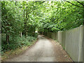
Old Park Lane
A public bridleway, also vehicle access to a few properties.
Image: © Robin Webster
Taken: 30 Jul 2015
0.10 miles
3
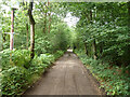
Old Park Lane
A public bridleway, also vehicle access to a few properties.
Image: © Robin Webster
Taken: 30 Jul 2015
0.11 miles
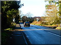
5
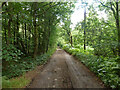
Old Park Lane
A public bridleway, also vehicle access to a few properties.
Image: © Robin Webster
Taken: 30 Jul 2015
0.15 miles
6
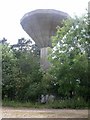
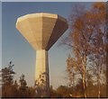
Water Tower
Water tower to the north of Farnham.
Image: © Ben Gamble
Taken: 19 Jun 2005
0.15 miles
7
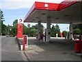
Old Park Service Station
On the A287 Odiham Road, Upper Hale, at the eastern edge of the square.
Image: © Ben Gamble
Taken: 19 Jun 2005
0.15 miles
8
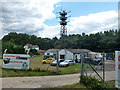
Amateur TV station, Odiham Road
Formerly a military radio installation, the main buildings are now home to an IT equipment refurbishment company. The interesting wooden mast, 26 m high, is now used by an amateur TV station, GB3HV - http://www.gb3hv.com/ . Apparently most of the antennae are now redundant.
Image: © Robin Webster
Taken: 30 Jul 2015
0.16 miles
10
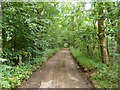
Old Park Lane
A public bridleway, also vehicle access to a few properties.
Image: © Robin Webster
Taken: 30 Jul 2015
0.19 miles