IMAGES TAKEN NEAR TO
Tattingstone Close, FARNHAM, GU10 3QY
Introduction
This page details the photographs taken nearby to Tattingstone Close, GU10 3QY by members of the Geograph project.
The Geograph project started in 2005 with the aim of publishing, organising and preserving representative images for every square kilometre of Great Britain, Ireland and the Isle of Man.

There are currently over 7.5m images from over14,400 individuals and you can help contribute to the project by visiting https://www.geograph.org.uk
Image Map
Images are licensed for reuse under creativecommons.org/licenses/by-sa/2.0
Notes
- Clicking on the map will re-center to the selected point.
- The higher the marker number, the further away the image location is from the centre of the postcode.
Image Listing (13 Images Found)
Images are licensed for reuse under creativecommons.org/licenses/by-sa/2.0
Image
Details
Distance
2
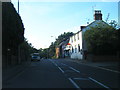
Temporary lights on Frensham Road, Bourne
Image: © David Howard
Taken: 11 Sep 2022
0.16 miles
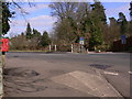
3
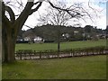
The Green at Bourne
This was taken from the grounds of st Martin's church. The road on the other side of the green is Old Frensham Road.
Image: © Shazz
Taken: 6 Mar 2011
0.17 miles
4
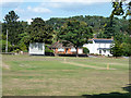
Tea time, recreation ground, Lower Bourne
Play has paused for tea.
Image: © Robin Webster
Taken: 8 Aug 2015
0.19 miles
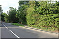
6
Crossroads on Frensham Road
Frensham Road is the A287. The picture is taken from Frensham Vale looking across to Latchwood Lane which has been made into a cul-de-sac by a barrier.
Image: © Shazz
Taken: 6 Mar 2011
0.22 miles
7
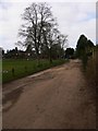
Dene Lane in Bourne
For a bridleway there are a lot of parked cars, but see Image
Image: © Shazz
Taken: 6 Mar 2011
0.22 miles
8
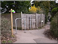
Two footpaths lead off Dene Lane
The one on the right is named as Dene Walk.
Image: © Shazz
Taken: 6 Mar 2011
0.23 miles
9
South elevation of St Martin by the Green at Bourne
Image: © Shazz
Taken: 6 Mar 2011
0.23 miles
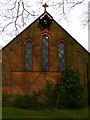
10

West elevation of St Martin by the Green at Bourne
Image: © Shazz
Taken: 6 Mar 2011
0.23 miles