IMAGES TAKEN NEAR TO
Runfold St. George, FARNHAM, GU10 1PP
Introduction
This page details the photographs taken nearby to Runfold St. George, GU10 1PP by members of the Geograph project.
The Geograph project started in 2005 with the aim of publishing, organising and preserving representative images for every square kilometre of Great Britain, Ireland and the Isle of Man.

There are currently over 7.5m images from over14,400 individuals and you can help contribute to the project by visiting https://www.geograph.org.uk
Image Map
Images are licensed for reuse under creativecommons.org/licenses/by-sa/2.0
Notes
- Clicking on the map will re-center to the selected point.
- The higher the marker number, the further away the image location is from the centre of the postcode.
Image Listing (27 Images Found)
Images are licensed for reuse under creativecommons.org/licenses/by-sa/2.0
Image
Details
Distance
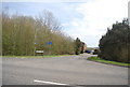
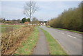
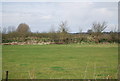
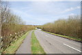
3
End of the road
Part of the old road from Badshot Lea to Runfold.
Image: © don cload
Taken: 4 Oct 2011
0.08 miles
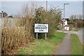
10
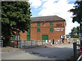
The Kiln Badshot Lea Village Hall, St. Georges Road, Badshot Lea
Image: © Oast House Archive
Taken: 7 Sep 2018
0.17 miles