IMAGES TAKEN NEAR TO
Hogs Back, FARNHAM, GU10 1LA
Introduction
This page details the photographs taken nearby to Hogs Back, GU10 1LA by members of the Geograph project.
The Geograph project started in 2005 with the aim of publishing, organising and preserving representative images for every square kilometre of Great Britain, Ireland and the Isle of Man.

There are currently over 7.5m images from over14,400 individuals and you can help contribute to the project by visiting https://www.geograph.org.uk
Image Map
Images are licensed for reuse under creativecommons.org/licenses/by-sa/2.0
Notes
- Clicking on the map will re-center to the selected point.
- The higher the marker number, the further away the image location is from the centre of the postcode.
Image Listing (12 Images Found)
Images are licensed for reuse under creativecommons.org/licenses/by-sa/2.0
Image
Details
Distance
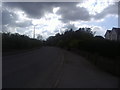
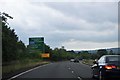
2
Hog's Back, Tongham
Leading to the A31 entrance and Aldershot beyond Tongham
Image: © David Howard
Taken: 7 May 2012
0.09 miles
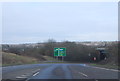
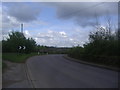
7
Descending to the Blackwater Valley Road
Image: © N Chadwick
Taken: 24 Jun 2017
0.17 miles
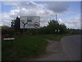
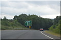
9
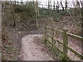
Zig-zag path going down from The Street to Thundery Hill
Image: © Shazz
Taken: 6 Mar 2011
0.20 miles
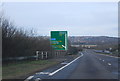
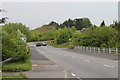
10
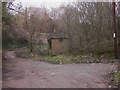
The north end of Thundery Hill
This dead end for vehicles continues as a zig-zag path which goes up to The Street.
Image: © Shazz
Taken: 6 Mar 2011
0.21 miles