
IMAGES TAKEN NEAR TO
Tolldown Road, BADMINTON, GL9 1JG
Introduction
This page details the photographs taken nearby to Tolldown Road, GL9 1JG by members of the Geograph project.
The Geograph project started in 2005 with the aim of publishing, organising and preserving representative images for every square kilometre of Great Britain, Ireland and the Isle of Man.

There are currently over 7.5m images from over14,400 individuals and you can help contribute to the project by visiting https://www.geograph.org.uk
Image Map
Images are licensed for reuse under creativecommons.org/licenses/by-sa/2.0
Notes
- Clicking on the map will re-center to the selected point.
- The higher the marker number, the further away the image location is from the centre of the postcode.
Image Listing (8 Images Found)
Images are licensed for reuse under creativecommons.org/licenses/by-sa/2.0
Image
Details
Distance
1
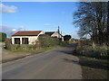
Tollgate Cottage
A view looking east along the old toll road to the crossroads on Marshfield Road, with Tollgate Cottage on the left.
Image: © Phil Williams
Taken: 10 Feb 2006
0.05 miles
2
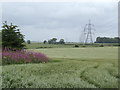
Pink of the willow-herb
Standing out against the grey-green of spring barley and the blue-grey of rainclouds. A parade of pylons marching across the southern Cotswold countryside for good measure.
Image: © Jonathan Billinger
Taken: 4 Jul 2007
0.06 miles
3
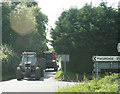
2009 : Farm vehicles arriving to collect the harvest
The combine was hard at work in the field behind and to the right.
Hinton and Pucklechurch are straight on and Tormarton to the right. Wonder how you get to Marshfield.
Image: © Maurice Pullin
Taken: 8 Aug 2009
0.07 miles
4
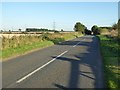
Marshfield Road
Marshfield Road to the south of Tormarton.
Image: © Philip Halling
Taken: 5 Oct 2016
0.10 miles
5
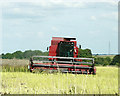
2009 : Cutting the oil seed rape
Combine harvester at work seen from Marshfield Road.
---------------------------------
Amended title by courtesy of a fellow Geographer.
Image: © Maurice Pullin
Taken: 8 Aug 2009
0.14 miles
6
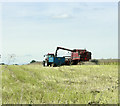
2009 : Harvesting oil seed rape
From the same field as Image
Image: © Maurice Pullin
Taken: 8 Aug 2009
0.14 miles
7
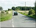
2009 : South east on Marshfield Road
Marshfield two and a half miles ahead, Tormarton nearly one mile behind.
Image: © Maurice Pullin
Taken: 8 Aug 2009
0.17 miles
8
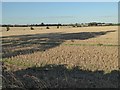
Stubble field near Tormarton
Stubble field to the south of the M4 motorway and the village of Tormarton.
Image: © Philip Halling
Taken: 5 Oct 2016
0.21 miles