IMAGES TAKEN NEAR TO
Lapdown Lane, BADMINTON, GL9 1JE
Introduction
This page details the photographs taken nearby to Lapdown Lane, GL9 1JE by members of the Geograph project.
The Geograph project started in 2005 with the aim of publishing, organising and preserving representative images for every square kilometre of Great Britain, Ireland and the Isle of Man.

There are currently over 7.5m images from over14,400 individuals and you can help contribute to the project by visiting https://www.geograph.org.uk
Image Map
Images are licensed for reuse under creativecommons.org/licenses/by-sa/2.0
Notes
- Clicking on the map will re-center to the selected point.
- The higher the marker number, the further away the image location is from the centre of the postcode.
Image Listing (30 Images Found)
Images are licensed for reuse under creativecommons.org/licenses/by-sa/2.0
Image
Details
Distance
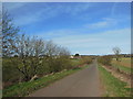
1
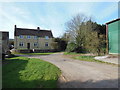
The Cotswold Way at Lower Lapdown Farm
The Cotswold Way, day five 8:43am
Image: © Ian S
Taken: 21 Apr 2013
0.02 miles
2
The Cotswold Way towards Lower Lapdown Farm
The Cotswold Way, day five 8:41am
Image: © Ian S
Taken: 21 Apr 2013
0.03 miles
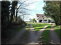
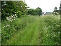
4
Road to Lower Lapdown Farm
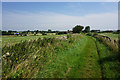
The Cotswold Way takes the road to the right, followed by a path round the back of the farm.
Image: © Bill Boaden
Taken: 20 Jul 2016
0.07 miles
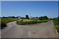
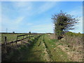
6
Bridleway at Lower Lapdown Farm
Bridleway and Cotswold Way approaching Lower Lapdown Farm near Tormarton.
Image: © Philip Halling
Taken: 1 Jul 2021
0.08 miles
7
The Cotswold Way towards Beacon Lane
The Cotswold Way, day five 8:46am
Image: © Ian S
Taken: 21 Apr 2013
0.11 miles
8
The Cotswold Way towards Lower Lapdown Farm
The Cotswold Way, day five 8:40am
Image: © Ian S
Taken: 21 Apr 2013
0.12 miles
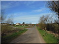
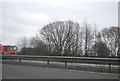
10
Bridleway towards Lower Lapdown Farm
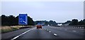
Crossing West Littleton Down. The M4 can be seen to the left.
Image: © Bill Boaden
Taken: 20 Jul 2016
0.14 miles