
IMAGES TAKEN NEAR TO
High Street, BADMINTON, GL9 1HZ
Introduction
This page details the photographs taken nearby to High Street, GL9 1HZ by members of the Geograph project.
The Geograph project started in 2005 with the aim of publishing, organising and preserving representative images for every square kilometre of Great Britain, Ireland and the Isle of Man.

There are currently over 7.5m images from over14,400 individuals and you can help contribute to the project by visiting https://www.geograph.org.uk
Image Map
Images are licensed for reuse under creativecommons.org/licenses/by-sa/2.0
Notes
- Clicking on the map will re-center to the selected point.
- The higher the marker number, the further away the image location is from the centre of the postcode.
Image Listing (180 Images Found)
Images are licensed for reuse under creativecommons.org/licenses/by-sa/2.0
Image
Details
Distance
1
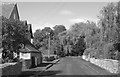
The Street, Tormarton, Gloucestershire 2012
Image: © Ray Bird
Taken: 19 Sep 2012
0.00 miles
2
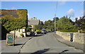
The Street, Tormarton, Gloucestershire 2012
Image: © Ray Bird
Taken: 19 Sep 2012
0.01 miles
3
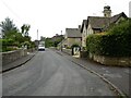
High Street, Tormarton
Cottages on Tormarton's High Street.
Image: © Philip Halling
Taken: 1 Jul 2021
0.01 miles
4
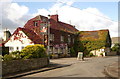
The Majors Retreat, Tormarton, Gloucestershire 2012
Formerly the Portcullis Inn. The Cotswold Way passes nearby and the Pub is regular used by walkers for refreshments.
Image: © Ray Bird
Taken: 21 Aug 2012
0.02 miles
5
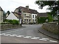
The Majors Retreat
The Majors Retreat in Tormarton.
Image: © Philip Halling
Taken: 1 Jul 2021
0.02 miles
6
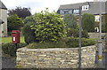
Postbox & Cotswold Way Signpost, Tormarton, Gloucestershire 2012
Image: © Ray Bird
Taken: 19 Sep 2012
0.02 miles
7
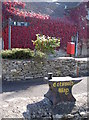
Iron marker
An anvil, set in a domestic wall, is not the sort of thing you would necessarily associate with the Cotswold Way footpath. Oddly enough, Tormarton's old smithy was a few houses further down the High Street.
Image: © Neil Owen
Taken: 10 Oct 2018
0.02 miles
8
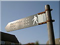
Metric sign in Tormanton
A sign that is also three-dimensional. Not many like that these days.
Image: © Neil Owen
Taken: 10 Oct 2018
0.02 miles
9
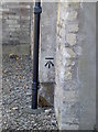
Benchmark in black
This benchmark, as listed in the Benchmark Database: https://www.bench-marks.org.uk/bm100760 , was originally on the corner of a schoolhouse in the village. However, the (now private) house was extended with a garage but fortunately the garage was not the same dimensions - hence the mark has not been obscured. Indeed, someone has marked it out in black especially. See Image] for a wider view.
Image: © Neil Owen
Taken: 10 Oct 2018
0.03 miles
10
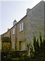
A silent bell
This is Tormarton's old schoolhouse, which served the community for many years before being converted into a private dwelling. Note the belltower has been retained, although the bell has fallen silent now. A benchmark can also be seen on the corner of the original building - see Image
Image: © Neil Owen
Taken: 10 Oct 2018
0.03 miles