
IMAGES TAKEN NEAR TO
Creephole, BADMINTON, GL9 1DZ
Introduction
This page details the photographs taken nearby to Creephole, GL9 1DZ by members of the Geograph project.
The Geograph project started in 2005 with the aim of publishing, organising and preserving representative images for every square kilometre of Great Britain, Ireland and the Isle of Man.

There are currently over 7.5m images from over14,400 individuals and you can help contribute to the project by visiting https://www.geograph.org.uk
Image Map
Images are licensed for reuse under creativecommons.org/licenses/by-sa/2.0
Notes
- Clicking on the map will re-center to the selected point.
- The higher the marker number, the further away the image location is from the centre of the postcode.
Image Listing (109 Images Found)
Images are licensed for reuse under creativecommons.org/licenses/by-sa/2.0
Image
Details
Distance
1
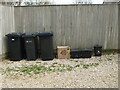
'Who gives a crap?'
A thought-provoking message near Creephole. Apparently, the box contained premium grade bamboo toilet paper.
Image: © Neil Owen
Taken: 31 Mar 2021
0.01 miles
2
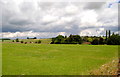
Oldbury-on-the-Hill from Chapel Walk, Didmarton, Gloucestershire 2014
Image: © Ray Bird
Taken: 7 Jul 2014
0.01 miles
3
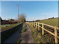
Road to Creephole, Didmarton
A view west from here. http://www.geograph.org.uk/photo/3302377 The road leads to Creephole and Creephole House.
Image: © Jaggery
Taken: 13 Jan 2013
0.03 miles
4
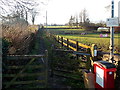
Northern end of Chapel Walk, Didmarton
The notice on the right shows that this is a public footpath only : no horses or motor vehicles.
Ahead is Didmarton Congregational Church http://www.geograph.org.uk/photo/3302366 and The Street, the main road through Didmarton.
Image: © Jaggery
Taken: 13 Jan 2013
0.07 miles
5
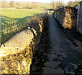
Walled section of Chapel Walk, Didmarton
The Chapel Walk houses are behind the camera. Ahead are fields, allotments and a Congregational Church. http://www.geograph.org.uk/photo/3302366
Image: © Jaggery
Taken: 13 Jan 2013
0.08 miles
6
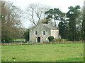
The old Union chapel
Situated a little distance north of the main part of Didmarton, the chapel was founded in 1843. It later became the Congregational chapel.
Image: © Neil Owen
Taken: 31 Mar 2021
0.08 miles
7

Chapel Walk Path, Didmarton, Gloucestershire 2014
Path to Chapel.
Image: © Ray Bird
Taken: 7 Jul 2014
0.08 miles
8
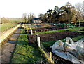
Didmarton allotments
The allotments are on the east side of Chapel Walk.
In the distance is Didmarton Congregational Church. http://www.geograph.org.uk/photo/3302366
Image: © Jaggery
Taken: 13 Jan 2013
0.08 miles
9
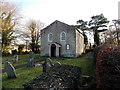
Grade II listed Congregational Church, Didmarton
Set back from Chapel Walk about 200 metres NNE of The Street, the main road through the village.
The former Union Chapel was built in 1843. Grade II listed in March 1987.
Image: © Jaggery
Taken: 13 Jan 2013
0.09 miles
10
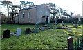
Churchyard and Grade II listed Congregational Church, Didmarton
Viewed from Chapel Walk about 250 metres NNE of The Street, the main road through the village.
The former Union Chapel was built in 1843. Grade II listed in March 1987.
Image: © Jaggery
Taken: 13 Jan 2013
0.09 miles