
IMAGES TAKEN NEAR TO
Shipton Moyne, TETBURY, GL8 8PS
Introduction
This page details the photographs taken nearby to GL8 8PS by members of the Geograph project.
The Geograph project started in 2005 with the aim of publishing, organising and preserving representative images for every square kilometre of Great Britain, Ireland and the Isle of Man.

There are currently over 7.5m images from over14,400 individuals and you can help contribute to the project by visiting https://www.geograph.org.uk
Image Map
Images are licensed for reuse under creativecommons.org/licenses/by-sa/2.0
Notes
- Clicking on the map will re-center to the selected point.
- The higher the marker number, the further away the image location is from the centre of the postcode.
Image Listing (5 Images Found)
Images are licensed for reuse under creativecommons.org/licenses/by-sa/2.0
Image
Details
Distance
1
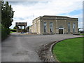
Bristol Waterworks pumping station
Situated beside the Fosse Way.
Image: © David Purchase
Taken: 1 Jul 2011
0.05 miles
3
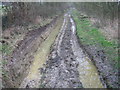
Cranmore Lane (bridleway)
The bridleway running SSE from Shipton Moyne is named as Cranmore Lane on the 1:25,000 OS map. What should be an attractive walk between a double hedge is being destroyed by motor vehicles, despite its legal classification as a bridleway rather than a road. It is so bad that in places it is virtually impassable and, judging by the lack of hoof prints, even the horse-riders have given up using it.
Image: © Caroline Tandy
Taken: 17 Feb 2007
0.18 miles
4
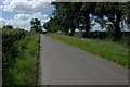
Road to Shipton Moyne
This unclassified country road briefly crosses the north-east corner of this grid square. Having crossed the Fosse Way which marks the county boundary, the road has just entered Gloucestershire.
Image: © Philip Halling
Taken: 22 Jun 2008
0.23 miles
5
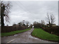
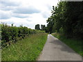
Fosse Way near Malmesbury
Looking northeast towards Fosse Cottages from where this roman road crosses the minor road southeast of Shipton Moyne.
Image: © michael ely
Taken: 13 Dec 2006
0.24 miles