IMAGES TAKEN NEAR TO
Chestnut Close, TETBURY, GL8 8LH
Introduction
This page details the photographs taken nearby to Chestnut Close, GL8 8LH by members of the Geograph project.
The Geograph project started in 2005 with the aim of publishing, organising and preserving representative images for every square kilometre of Great Britain, Ireland and the Isle of Man.

There are currently over 7.5m images from over14,400 individuals and you can help contribute to the project by visiting https://www.geograph.org.uk
Image Map
Images are licensed for reuse under creativecommons.org/licenses/by-sa/2.0
Notes
- Clicking on the map will re-center to the selected point.
- The higher the marker number, the further away the image location is from the centre of the postcode.
Image Listing (24 Images Found)
Images are licensed for reuse under creativecommons.org/licenses/by-sa/2.0
Image
Details
Distance
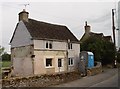
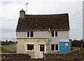
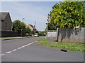
1

Chavenage Lane, Tetbury
Residential houses on Chavenage Lane in Tetbury.
Image: © Philip Halling
Taken: 21 Apr 2012
0.06 miles
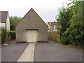
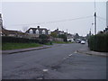
4
Romney Road junction with Chavenage Lane Tetbury
Image: © Paul Best
Taken: 19 May 2014
0.10 miles
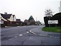
6
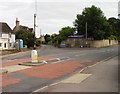
Junction of Chavenage Lane with Hampton Street Tetbury
Image: © Paul Best
Taken: 6 Jul 2014
0.17 miles