IMAGES TAKEN NEAR TO
Cirencester Road, TETBURY, GL8 8GJ
Introduction
This page details the photographs taken nearby to Cirencester Road, GL8 8GJ by members of the Geograph project.
The Geograph project started in 2005 with the aim of publishing, organising and preserving representative images for every square kilometre of Great Britain, Ireland and the Isle of Man.

There are currently over 7.5m images from over14,400 individuals and you can help contribute to the project by visiting https://www.geograph.org.uk
Image Map
Images are licensed for reuse under creativecommons.org/licenses/by-sa/2.0
Notes
- Clicking on the map will re-center to the selected point.
- The higher the marker number, the further away the image location is from the centre of the postcode.
Image Listing (54 Images Found)
Images are licensed for reuse under creativecommons.org/licenses/by-sa/2.0
Image
Details
Distance
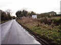
1
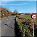
Bend ahead - 40mph speed limit on Cirencester Road north of Tetbury
Ilsom Farm is ahead on the right.
Image: © Jaggery
Taken: 13 Jan 2013
0.03 miles
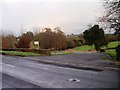
2
Public footpath to Wor Well near Tetbury
From Cirencester Road. Wor Well is shown on maps as the source of the River Avon (Tetbury branch).
Image: © Jaggery
Taken: 13 Jan 2013
0.05 miles
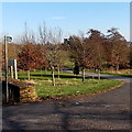
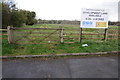
5
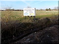
Quercus Park development site near Tetbury
Viewed from Cirencester Road beyond the northern boundary of Tetbury. Quercus is Latin for oak.
Image: © Jaggery
Taken: 13 Jan 2013
0.07 miles
6
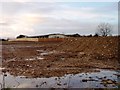
Development land between Cirencester Road and Quercus Road Tetbury
Image: © Paul Best
Taken: 28 Jan 2014
0.07 miles
7
Development land Cirencester road Tetbury
Image: © Paul Best
Taken: 28 Jan 2014
0.08 miles
8
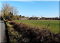
Ilsom Farm near Tetbury
Viewed from Cirencester Road.
Image: © Jaggery
Taken: 13 Jan 2013
0.10 miles
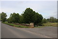
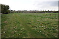
9
Development land, Tetbury
Land on the edge of Tetbury to the south of London Road available for redevelopment.
Image: © Philip Halling
Taken: 21 Apr 2012
0.10 miles
10
Land awaiting development, Tetbury
These fields are on the edge of the town of Tetbury and are available for redevelopment.
Image: © Philip Halling
Taken: 21 Apr 2012
0.11 miles