IMAGES TAKEN NEAR TO
Hatter Close, TETBURY, GL8 8FL
Introduction
This page details the photographs taken nearby to Hatter Close, GL8 8FL by members of the Geograph project.
The Geograph project started in 2005 with the aim of publishing, organising and preserving representative images for every square kilometre of Great Britain, Ireland and the Isle of Man.

There are currently over 7.5m images from over14,400 individuals and you can help contribute to the project by visiting https://www.geograph.org.uk
Image Map
Images are licensed for reuse under creativecommons.org/licenses/by-sa/2.0
Notes
- Clicking on the map will re-center to the selected point.
- The higher the marker number, the further away the image location is from the centre of the postcode.
Image Listing (66 Images Found)
Images are licensed for reuse under creativecommons.org/licenses/by-sa/2.0
Image
Details
Distance
1
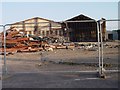
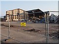
Demolition of the former SIAC Tetbury Steel buildings
Image: © Paul Best
Taken: 9 Sep 2013
0.02 miles
2
Demolition of the former Tetbury Steel buildings
Image: © Paul Best
Taken: 9 Sep 2013
0.02 miles
3
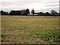
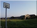
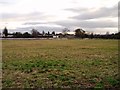
Looking towards Northfield Close over development land from Quercus Road Tetbury
Image: © Paul Best
Taken: 28 Jan 2014
0.03 miles
4

Demolition of the former Tetbury Steel works
Image: © Paul Best
Taken: 9 Sep 2013
0.03 miles
5
Demolition of the former SIAC buildings in Tetbury
Image: © Paul Best
Taken: 9 Sep 2013
0.05 miles
7
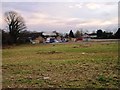
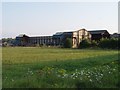
Looking towards the rear of Cirencester Road Industrial Estate from Quercus Road Tetbury
Image: © Paul Best
Taken: 28 Jan 2014
0.06 miles
8
Demolition of the former SIAC buildings in Tetbury
Image: © Paul Best
Taken: 9 Sep 2013
0.06 miles
9

Demolition of the former SIAC and Matbro Bray buildings in Tetbury
Image: © Paul Best
Taken: 9 Sep 2013
0.07 miles
10
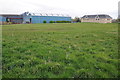
Business premises, Tetbury
Business premises, old and new, off London Road in Tetbury.
Image: © Philip Halling
Taken: 21 Apr 2012
0.07 miles