IMAGES TAKEN NEAR TO
St. Marys Road, TETBURY, GL8 8BQ
Introduction
This page details the photographs taken nearby to St. Marys Road, GL8 8BQ by members of the Geograph project.
The Geograph project started in 2005 with the aim of publishing, organising and preserving representative images for every square kilometre of Great Britain, Ireland and the Isle of Man.

There are currently over 7.5m images from over14,400 individuals and you can help contribute to the project by visiting https://www.geograph.org.uk
Image Map
Images are licensed for reuse under creativecommons.org/licenses/by-sa/2.0
Notes
- Clicking on the map will re-center to the selected point.
- The higher the marker number, the further away the image location is from the centre of the postcode.
Image Listing (26 Images Found)
Images are licensed for reuse under creativecommons.org/licenses/by-sa/2.0
Image
Details
Distance
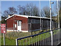
6
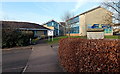
St Mary's Church of England Primary School, Tetbury
Viewed from St Mary's Road.
Image: © Jaggery
Taken: 13 Jan 2013
0.16 miles
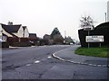
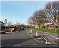
8
Courthouse Road, Tetbury
Viewed across London Road.
Image: © Jaggery
Taken: 13 Jan 2013
0.19 miles
9
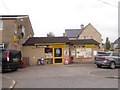
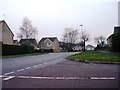
Longtree Close, Tetbury
A small modern housing estate
Image: © David Smith
Taken: 8 Jun 2018
0.19 miles
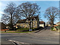
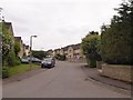
10
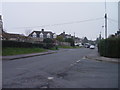
20mph zone along St Mary's Road in Tetbury
St Mary's Primary School is ahead.
Image: © Jaggery
Taken: 13 Jan 2013
0.21 miles