
IMAGES TAKEN NEAR TO
Daglingworth, CIRENCESTER, GL7 7HY
Introduction
This page details the photographs taken nearby to GL7 7HY by members of the Geograph project.
The Geograph project started in 2005 with the aim of publishing, organising and preserving representative images for every square kilometre of Great Britain, Ireland and the Isle of Man.

There are currently over 7.5m images from over14,400 individuals and you can help contribute to the project by visiting https://www.geograph.org.uk
Image Map
Images are licensed for reuse under creativecommons.org/licenses/by-sa/2.0
Notes
- Clicking on the map will re-center to the selected point.
- The higher the marker number, the further away the image location is from the centre of the postcode.
Image Listing (4 Images Found)
Images are licensed for reuse under creativecommons.org/licenses/by-sa/2.0
Image
Details
Distance
1
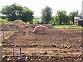
First pig!
This beast is blissfully unaware that after 164 miles of walking this is the first pig I have seen on the Macmillan Way trip. In hindsight there were only 8 more on the other 126 miles. Rare beasts indeed. This farm is shown on the 1:50K map but is inexplicably missing on the 1:25K. Perhaps this is one of the OS deliberate errors to spot copyright theft.
Image: © Graham Horn
Taken: 30 Apr 2007
0.05 miles
2
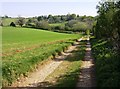
Bridleway towards the Duntisbournes
Looking east on a bridleway from Overley Wood to the Duntisbournes.
Image: © Graham Horn
Taken: 30 Apr 2007
0.16 miles
3
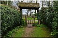
Duntisbourne Rouse, St. Michael's Church: The lych gate, a fair distance from the church
Image: © Michael Garlick
Taken: 25 Apr 2016
0.24 miles
4
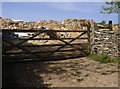
Duntisbourne tip
Probably unofficial, but it does seem that rubbish, mainly builders rubble, is being collected here. Nearly opposite the church.
Image: © Graham Horn
Taken: 30 Apr 2007
0.25 miles