IMAGES TAKEN NEAR TO
Rendcomb, CIRENCESTER, GL7 7DG
Introduction
This page details the photographs taken nearby to GL7 7DG by members of the Geograph project.
The Geograph project started in 2005 with the aim of publishing, organising and preserving representative images for every square kilometre of Great Britain, Ireland and the Isle of Man.

There are currently over 7.5m images from over14,400 individuals and you can help contribute to the project by visiting https://www.geograph.org.uk
Image Map
Images are licensed for reuse under creativecommons.org/licenses/by-sa/2.0
Notes
- Clicking on the map will re-center to the selected point.
- The higher the marker number, the further away the image location is from the centre of the postcode.
Image Listing (4 Images Found)
Images are licensed for reuse under creativecommons.org/licenses/by-sa/2.0
Image
Details
Distance
1
Cottages by lane to Chittlegrove
Image: © Jonathan Billinger
Taken: 27 Nov 2006
0.17 miles
2
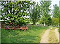
Permissive path near Chittlegrove
This is a section of track that for about 200 yards is not technically a right of way. The footpath goes across the field on the other side of the wall. However, everyone follows this clear track; most people are probably completely unaware that they have left the footpath. An example of where a path diversion should be applied for to bring the legal route in line with practical route?
Image: © Graham Horn
Taken: 29 Apr 2007
0.17 miles
3

Field south of Chittlegrove
A large field of wheat south of Chittlegrove, from the byway running across the southern part of the square. Chittlegrove (a farm) can be seen on the right horizon. The line of trees is on the north-south road called White Way.
Image: © Graham Horn
Taken: 29 Apr 2007
0.20 miles