IMAGES TAKEN NEAR TO
Lower End, CIRENCESTER, GL7 7AL
Introduction
This page details the photographs taken nearby to Lower End, GL7 7AL by members of the Geograph project.
The Geograph project started in 2005 with the aim of publishing, organising and preserving representative images for every square kilometre of Great Britain, Ireland and the Isle of Man.

There are currently over 7.5m images from over14,400 individuals and you can help contribute to the project by visiting https://www.geograph.org.uk
Image Map
Images are licensed for reuse under creativecommons.org/licenses/by-sa/2.0
Notes
- Clicking on the map will re-center to the selected point.
- The higher the marker number, the further away the image location is from the centre of the postcode.
Image Listing (91 Images Found)
Images are licensed for reuse under creativecommons.org/licenses/by-sa/2.0
Image
Details
Distance
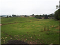
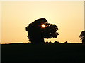
2
An evening view north, near Lower End, Gloucestershire
The buildings in this view mark the southern extent of the village of Lower End. The bridleway, in good condition, is gated at its entrance a little way further on from here.
Image: © Brian Robert Marshall
Taken: 6 Jun 2007
0.13 miles
3
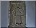
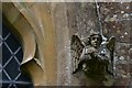
Daglingworth, The Holy Rood Church: St. Peter with the key to the Gates of Heaven, one of four Anglo Saxon wall mounted plaques
Image: © Michael Garlick
Taken: 25 Apr 2016
0.13 miles
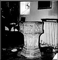
4
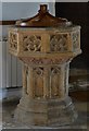
Daglingworth, The Holy Rood Church: The octagonal c15th font
Image: © Michael Garlick
Taken: 25 Apr 2016
0.13 miles
5
Daglingworth, The Holy Rood Church: Label stop 3
Image: © Michael Garlick
Taken: 25 Apr 2016
0.13 miles
6
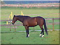
Horse in a paddock near Lower End, Gloucestershire
Looking in peak condition, this beautiful horse has an identification number on its back.
Image: © Brian Robert Marshall
Taken: 6 Jun 2007
0.13 miles
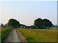
7
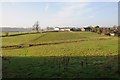
Manor Farm, Daglingworth
Manor Farm is situated on the southern edge of the Cotswold village of Daglingworth.
Image: © Philip Halling
Taken: 29 Nov 2014
0.15 miles
8
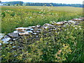
A view to the north-east near Lower End, Gloucestershire
A nicely weathered dry-stone wall in the foreground. Manor Farm is just visible at the extreme left of the image.
Image: © Brian Robert Marshall
Taken: 6 Jun 2007
0.19 miles
9
Daglingworth Holy Rood
Font 15th century
Image: © Alan Longbottom
Taken: Unknown
0.19 miles
10
Tree, near Lower End, Gloucestershire
There may be two trees here but from this angle it looks like one.
Image: © Brian Robert Marshall
Taken: 6 Jun 2007
0.20 miles