
IMAGES TAKEN NEAR TO
Coates, CIRENCESTER, GL7 6PP
Introduction
This page details the photographs taken nearby to GL7 6PP by members of the Geograph project.
The Geograph project started in 2005 with the aim of publishing, organising and preserving representative images for every square kilometre of Great Britain, Ireland and the Isle of Man.

There are currently over 7.5m images from over14,400 individuals and you can help contribute to the project by visiting https://www.geograph.org.uk
Image Map
Images are licensed for reuse under creativecommons.org/licenses/by-sa/2.0
Notes
- Clicking on the map will re-center to the selected point.
- The higher the marker number, the further away the image location is from the centre of the postcode.
Image Listing (14 Images Found)
Images are licensed for reuse under creativecommons.org/licenses/by-sa/2.0
Image
Details
Distance
2
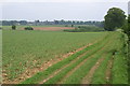
Monarch's Way near Cirencester
This LDP follows the flight of Charles II after his defeat at Worcester. The Royal Agricultural College can be seen on the skyline.
Image: © Peter Standing
Taken: 14 May 2006
0.07 miles
3
![Four ways to go [2]](https://s1.geograph.org.uk/geophotos/06/00/43/6004377_e3dc95de_120x120.jpg)
Four ways to go [2]
Two footpaths cross at this point. This is looking along the track, part of The Monarch's Way, in the direction of Cirencester. The building in the distance is Field Barn, part of Coates Manor Farm.
The Monarch's Way is a 615-mile long-distance footpath in England that approximates the escape route taken by King Charles II in 1651 after being defeated in the Battle of Worcester.
Coates Manor Farm is part of the Royal Agricultural University located near Cirencester. Established in 1845, it is the first agricultural college in the English-speaking world.
Image: © Michael Dibb
Taken: 21 Oct 2018
0.08 miles
4
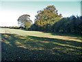
On the Monarch's Way [18]
At this point the path makes a sharp left turn and follows the field edge towards the track.
The Monarch's Way is a 615-mile long-distance footpath in England that approximates the escape route taken by King Charles II in 1651 after being defeated in the Battle of Worcester.
Image: © Michael Dibb
Taken: 21 Oct 2018
0.11 miles
5
![Four ways to go [1]](https://s0.geograph.org.uk/geophotos/06/00/43/6004376_46bd87f9_120x120.jpg)
Four ways to go [1]
Two footpaths cross at this point. This is looking back along the path, part of The Monarch's Way, in the direction of The Thames & Severn Canal.
The Monarch's Way is a 615-mile long-distance footpath in England that approximates the escape route taken by King Charles II in 1651 after being defeated in the Battle of Worcester.
Image: © Michael Dibb
Taken: 21 Oct 2018
0.11 miles
6
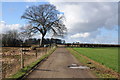
The Monarch's Way near Coates
The Monarch's Way near Field Barn to the east of Coates.
Image: © Philip Halling
Taken: 1 Mar 2014
0.11 miles
7
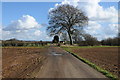
Track and footpath
Track and footpath approaching Field Barn to the east of Coates.
Image: © Philip Halling
Taken: 1 Mar 2014
0.13 miles
8
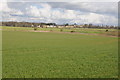
The Royal Agricultural College
View across farmland to The Royal Agricultural College at Cirencester.
Image: © Philip Halling
Taken: 1 Mar 2014
0.13 miles
9
![Four ways to go [3]](https://s1.geograph.org.uk/geophotos/06/00/43/6004385_97af553c_120x120.jpg)
Four ways to go [3]
Two footpaths cross at this point. This is looking along the track, a public footpath, towards the outbuildings of Coates Manor Farm.
Coates Manor Farm is part of the Royal Agricultural University located near Cirencester. Established in 1845, it is the first agricultural college in the English-speaking world.
Image: © Michael Dibb
Taken: 21 Oct 2018
0.17 miles
10
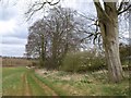
Beeches by the Monarch's Way
An intermittent line of tall beeches overlooks the trail as it gently descends into a shallow dry valley east of Field Barn.
Image: © Derek Harper
Taken: 30 Mar 2009
0.17 miles