
IMAGES TAKEN NEAR TO
Mottershead Road, CIRENCESTER, GL7 6JE
Introduction
This page details the photographs taken nearby to Mottershead Road, GL7 6JE by members of the Geograph project.
The Geograph project started in 2005 with the aim of publishing, organising and preserving representative images for every square kilometre of Great Britain, Ireland and the Isle of Man.

There are currently over 7.5m images from over14,400 individuals and you can help contribute to the project by visiting https://www.geograph.org.uk
Image Map
Images are licensed for reuse under creativecommons.org/licenses/by-sa/2.0
Notes
- Clicking on the map will re-center to the selected point.
- The higher the marker number, the further away the image location is from the centre of the postcode.
Image Listing (4 Images Found)
Images are licensed for reuse under creativecommons.org/licenses/by-sa/2.0
Image
Details
Distance
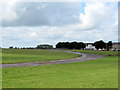
2
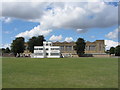
South Cerney Army Station
Hangars and other buildings at the former South Cerney Airfield.
Image: © Gareth James
Taken: 3 Aug 2013
0.24 miles
3
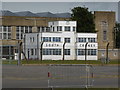
South Cerney airfield
Former RAF base now used by the Army and having two short runways used by parachuting clubs. It is now known as the Duke of Gloucester Barracks.
Image: © Chris Allen
Taken: 2 Aug 2015
0.24 miles
4
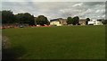
RAF South Cerney
This view north shows various buildings adjacent to the airfield including the white art deco control tower at the right. The airfield was developed in the late 1930s and was primarily for pilot training. It is now an Army establishment, the Duke of Gloucester Barracks.
Image: © Brian Robert Marshall
Taken: 6 Aug 2017
0.25 miles