
IMAGES TAKEN NEAR TO
Riverway, CIRENCESTER, GL7 6HZ
Introduction
This page details the photographs taken nearby to Riverway, GL7 6HZ by members of the Geograph project.
The Geograph project started in 2005 with the aim of publishing, organising and preserving representative images for every square kilometre of Great Britain, Ireland and the Isle of Man.

There are currently over 7.5m images from over14,400 individuals and you can help contribute to the project by visiting https://www.geograph.org.uk
Image Map
Images are licensed for reuse under creativecommons.org/licenses/by-sa/2.0
Notes
- Clicking on the map will re-center to the selected point.
- The higher the marker number, the further away the image location is from the centre of the postcode.
Image Listing (35 Images Found)
Images are licensed for reuse under creativecommons.org/licenses/by-sa/2.0
Image
Details
Distance
1
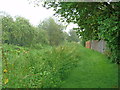
Riverside path
The well-tended public footpath runs on the bank of the south channel of the river Churn.
Image: © Michael Dibb
Taken: 12 Aug 2012
0.02 miles
2
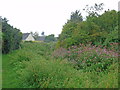
There is a river here
A public footpath runs alongside the south channel of the river Churn. The luxuriant growth on the bank hides the water from view.
Image: © Michael Dibb
Taken: 12 Aug 2012
0.06 miles
3
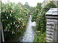
South Cerney Churn
Just north east of South Cerney, the river Churn divides into two channels. This is the northern channel, seen from School Lane.
Image: © Michael Dibb
Taken: 12 Aug 2012
0.08 miles
4
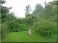
Gate on the path
The path to this point has been enclosed between the south channel of the river Churn and the garden fences. Beyond the gate the path continues to follow the river but now runs in open fields.
Image: © Michael Dibb
Taken: 12 Aug 2012
0.08 miles
5
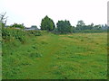
Towards the road
From the riverside path, another path runs to meet the minor road.
Image: © Michael Dibb
Taken: 12 Aug 2012
0.09 miles
6
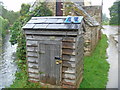
River level gauging station
This small wooden building alongside the river Churn in School Lane, South Cerney is a river level gauging station operated by the Environment Agency.
Image: © Michael Dibb
Taken: 12 Aug 2012
0.09 miles
7
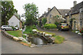
The River Churn at South Cerney
One of two courses of the river through the village, viewed in light rain.
Image: © Bill Boaden
Taken: 26 May 2018
0.14 miles
8
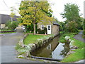
Water everywhere
The bank-side house has water on both sides. One channel runs underneath where the camera is located. The hump of the bridge to the left of the image takes the road over the other channel. The thatched building to the back of the left of the image is the village hall (see Image).
Image: © Michael Dibb
Taken: 12 Aug 2012
0.14 miles
9
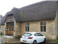
Village Hall
This attractive building, once a barn, is now the village hall for South Cerney. Late 18th or early 19th century, the building is listed grade II and further details are at https://historicengland.org.uk/listing/the-list/list-entry/1090064
Image: © Michael Dibb
Taken: 12 Aug 2012
0.15 miles
10
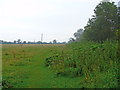
Alongside the river
Now in an open field, the footpath continues to follow the river which is hidden behind the foliage to the right of the image.
Image: © Michael Dibb
Taken: 12 Aug 2012
0.16 miles