
IMAGES TAKEN NEAR TO
Oaksey Road, CIRENCESTER, GL7 6DZ
Introduction
This page details the photographs taken nearby to Oaksey Road, GL7 6DZ by members of the Geograph project.
The Geograph project started in 2005 with the aim of publishing, organising and preserving representative images for every square kilometre of Great Britain, Ireland and the Isle of Man.

There are currently over 7.5m images from over14,400 individuals and you can help contribute to the project by visiting https://www.geograph.org.uk
Image Map
Images are licensed for reuse under creativecommons.org/licenses/by-sa/2.0
Notes
- Clicking on the map will re-center to the selected point.
- The higher the marker number, the further away the image location is from the centre of the postcode.
Image Listing (21 Images Found)
Images are licensed for reuse under creativecommons.org/licenses/by-sa/2.0
Image
Details
Distance
1
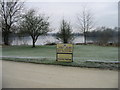
Friday Island, Cotswolds Water Park
At 40 square miles the Cotswold Water Park is approximately the same size as the Island of Jersey. It is that part of the Upper Thames catchment in North Wiltshire & South Gloucestershire which has been subjected to over 50 years of sand & gravel extraction.
http://www.waterpark.org/leisure/what-is-the-cotswold-water-park.html
Image: © Nick Smith
Taken: 4 Jan 2009
0.13 miles
2
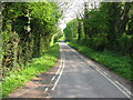
Road running along western side of Neigh Bridge Lake
Image: © Nick Smith
Taken: 19 Apr 2011
0.15 miles
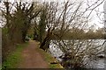
4
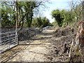
Bridleway near fenced-off lake
The fierce fencing of the private fishing lake to the south has preserved the bridleway but not in the prettiest state.
Image: © Vieve Forward
Taken: 4 May 2016
0.17 miles
5
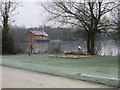
View of Friday Island in the Cotswolds Water Park
At 40 square miles the Cotswold Water Park is approximately the same size as the Island of Jersey. It is that part of the Upper Thames catchment in North Wiltshire & South Gloucestershire which has been subjected to over 50 years of sand & gravel extraction.
Image: © Nick Smith
Taken: 4 Jan 2009
0.18 miles
7
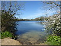
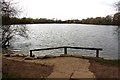
Neigh Bridge Lake, Neigh Bridge Country Park
This country park is open all year round with plenty of parking, picnic benches, lakeside walks and a small playground for youngsters. The lake is a former gravel pit.
Image: © Vieve Forward
Taken: 20 Apr 2016
0.19 miles
8
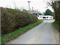
The road to the Somerford Keynes road, south of Poole Keynes
The Somerford Keynes road is visible beyond the 'T' junction. Beyond that is the Goodman Bros auto-dealer. I'm not sure if the firm is still trading as their website is broken.
Image: © Brian Robert Marshall
Taken: 29 Mar 2011
0.19 miles
9
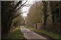
The road to the car park
The car park is for Neigh Bridge Country Park.
Image: © Steve Daniels
Taken: 14 Apr 2013
0.19 miles
10
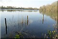
Neigh Bridge Lake
Neigh Bridge Lake, a lake created from gravel extraction.
Image: © Philip Halling
Taken: 25 Mar 2022
0.19 miles