
IMAGES TAKEN NEAR TO
Kemble, CIRENCESTER, GL7 6AQ
Introduction
This page details the photographs taken nearby to GL7 6AQ by members of the Geograph project.
The Geograph project started in 2005 with the aim of publishing, organising and preserving representative images for every square kilometre of Great Britain, Ireland and the Isle of Man.

There are currently over 7.5m images from over14,400 individuals and you can help contribute to the project by visiting https://www.geograph.org.uk
Image Map
Images are licensed for reuse under creativecommons.org/licenses/by-sa/2.0
Notes
- Clicking on the map will re-center to the selected point.
- The higher the marker number, the further away the image location is from the centre of the postcode.
Image Listing (247 Images Found)
Images are licensed for reuse under creativecommons.org/licenses/by-sa/2.0
Image
Details
Distance
1
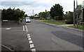
Kemble railway station car park ahead
Windmill Road (ahead) leads to the main Kemble railway station car park.
Walkers can reach the station this way, but a shorter route is via Station Road on the left.
Image: © Jaggery
Taken: 14 Jun 2015
0.02 miles
2
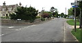
Kemble railway station direction signs, Windmill Road, Kemble
For walkers, the shortest route to the station is via Station Road on the left. http://www.geograph.org.uk/photo/5416942
The station car park is reached via Windmill Road ahead.
Image: © Jaggery
Taken: 4 Jun 2017
0.02 miles
3
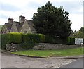
Directions sign, Windmill Road, Kemble
The corner of Glebe Lane is on the left.
Image: © Jaggery
Taken: 14 Jun 2015
0.02 miles
4
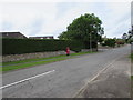
Windmill Road pillarbox, Kemble
Viewed across Windmill Road from the corner of the A429. Next left ahead is Station Road.
Image: © Jaggery
Taken: 4 Jun 2017
0.03 miles
5
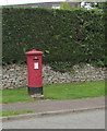
King George V pillarbox, Windmill Road, Kemble
Located here. http://www.geograph.org.uk/photo/5416965 The GR on the box is short for Georgius Rex, Latin for King George,
in this case King George V who reigned from May 1910-January 1936
Image: © Jaggery
Taken: 4 Jun 2017
0.03 miles
6
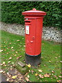
Kemble: postbox № GL7 85, Windmill Road
This large George V-reign postbox stands just down the road from Image It thoughtfully has a little wooden kneeling board for the postman when he empties the box, and is probably useful for small children posting letters too.
Image: © Chris Downer
Taken: 13 Nov 2012
0.03 miles
7
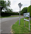
Windmill Road direction sign, Kemble
The sign, 2½ miles from Tarlton, is at the southern end of Windmill Road facing the A429.
Kemble Stn is Kemble railway station.
Image: © Jaggery
Taken: 4 Jun 2017
0.03 miles
8
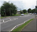
Pelican crossing in Kemble
Across the A429 near the Windmill Road junction. Chambers Dictionary states that pelican in this context is adapted from "pedestrian light controlled crossing".
Image: © Jaggery
Taken: 4 Jun 2017
0.03 miles
9
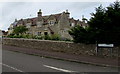
Station Road houses, Kemble
On the corner of Windmill Road. At the level of the upstairs window, embossed in the stonework in the middle of the facade, is a capital letter B with coronet above, showing that the houses were built as part of the estate of the Duke of Beaufort.
Image: © Jaggery
Taken: 4 Jun 2017
0.03 miles
10
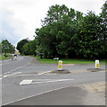
Windmill Road pedestrian refuge, Kemble
The refuge at the southern end of Windmill Road, near the A429 junction,
lets walkers cross half a road width at a time when traffic is busy.
Image: © Jaggery
Taken: 4 Jun 2017
0.04 miles