
IMAGES TAKEN NEAR TO
Poulton, CIRENCESTER, GL7 5TB
Introduction
This page details the photographs taken nearby to GL7 5TB by members of the Geograph project.
The Geograph project started in 2005 with the aim of publishing, organising and preserving representative images for every square kilometre of Great Britain, Ireland and the Isle of Man.

There are currently over 7.5m images from over14,400 individuals and you can help contribute to the project by visiting https://www.geograph.org.uk
Image Map
Images are licensed for reuse under creativecommons.org/licenses/by-sa/2.0
Notes
- Clicking on the map will re-center to the selected point.
- The higher the marker number, the further away the image location is from the centre of the postcode.
Image Listing (14 Images Found)
Images are licensed for reuse under creativecommons.org/licenses/by-sa/2.0
Image
Details
Distance
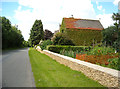
2
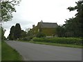
Sunhill Farmhouse
Climber-bedecked farmhouse next to Image
Image: © Mike Faherty
Taken: 15 May 2011
0.01 miles
5
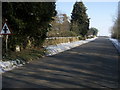
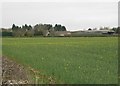
Road from Betty's Grave at Sunhill
Road from Betty's Grave at Sunhill, the mile post by the sign declares Cirencester 6 miles and London 84 miles
Image: © Shaun Ferguson
Taken: 11 Feb 2012
0.03 miles
6
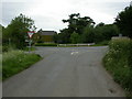
Sunhill, crossroads
Coming from Fairford: sharp left, to Meysey Hampton; left, Cirencester; half right, Ready Token; sharp right, Quenington.
Image: © Mike Faherty
Taken: 15 May 2011
0.03 miles
7
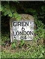
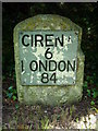
Old Milestone by Sunhill crossroads, Maiseyhampton Parish
Metal plate attached to stone post by the UC road, in parish of MAISEYHAMPTON (COTSWOLD District), Sunhill; West of crossroads by Sunhill Bungalow, under cypress hedge against wall, on North side of road. Cirencester iron plate, erected by the Cirencester to St John's Bridge turnpike trust in the 19th century.
Inscription reads:-
CIRENR
6
LONDON
84
Milestone Society National ID: GL_CISR06.
Image: © M Faherty
Taken: 15 May 2011
0.03 miles
8
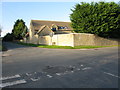
Road junction at Sunhill
The road joining from the NW is the Welsh Way.
Image: © Nick Smith
Taken: 26 Oct 2009
0.05 miles
9
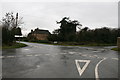
"Five ways"
Meeting of minor roads near Honeycombe Leaze
Image: © andrew auger
Taken: 13 Dec 2008
0.05 miles
10
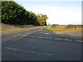
Road junctions at Sunhill
The road off to the lower right of the photo is part of the Welsh Way which joins the junction from the NW and then heads SE at this point.
Image: © Nick Smith
Taken: 26 Oct 2009
0.09 miles