
IMAGES TAKEN NEAR TO
Kingshill Lane, CIRENCESTER, GL7 5PP
Introduction
This page details the photographs taken nearby to Kingshill Lane, GL7 5PP by members of the Geograph project.
The Geograph project started in 2005 with the aim of publishing, organising and preserving representative images for every square kilometre of Great Britain, Ireland and the Isle of Man.

There are currently over 7.5m images from over14,400 individuals and you can help contribute to the project by visiting https://www.geograph.org.uk
Image Map
Images are licensed for reuse under creativecommons.org/licenses/by-sa/2.0
Notes
- Clicking on the map will re-center to the selected point.
- The higher the marker number, the further away the image location is from the centre of the postcode.
Image Listing (10 Images Found)
Images are licensed for reuse under creativecommons.org/licenses/by-sa/2.0
Image
Details
Distance
1
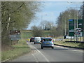
Dual carriageway section of the A419 north of Siddington
Image: © Sarah Charlesworth
Taken: 4 Mar 2010
0.06 miles
2
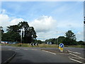
Roundabout on Ermine Way approaching Cirencester
Image: © Roy Hughes
Taken: 20 Jun 2020
0.08 miles
3
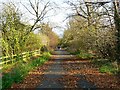
Cricklade Road, Cirencester
Not so many years ago this leafy lane was the main road to Gloucester from the south. It is an old Roman road, Ermin Street. It has been by-passed and gated at the viewpoint but access is allowed for recreational uses such as dog-walking.
Image: © Brian Robert Marshall
Taken: 10 Nov 2007
0.09 miles
5
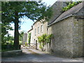
Preston Mill
Preston Mill was recently on the market and it included the five bedroom 18th Century millers house and the attached former mill. There are many outbuildings including including a 50ft long barn.
As well as everything else it has a tennis court, some paddocks (about 6.3 acres) and rights to single bank fishing on the river Churn.
It was on the market in 2010 at £1.25 million
Image: © Nigel Mykura
Taken: 17 Jun 2012
0.16 miles
6
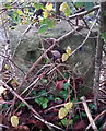
Old Milestone, Cirencester
In the parish of Preston on the old route of the Ermin Street (Roman Road).
On the SW side past the entrance to the supermarket.
Erected by the Cirencester and Cricklade Turnpike Trust in the 19ᵗʰ century.
Inscription (was): Cirencester 1 / Cricklade 6
Milestone Society National ID: GL_CICK01
Image: © Tom Blanden
Taken: 5 Dec 2022
0.17 miles
8
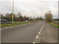
Looking back on the A419 towards Cirencester
The old town was once the Roman town of Corinium and is now often known as the capital of the Cotswolds.
Image: © James Denham
Taken: 12 Jan 2012
0.22 miles
9
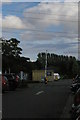
View south-east out of Tesco car park, Cirencester
Beyond the visual clutter of the car park and power lines, poplars mark the wet land along the River Churn.
Image: © Christopher Hilton
Taken: 12 Aug 2014
0.22 miles
10
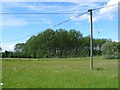
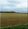
Fields Near Preston
This copse of tall poplars stands close to a substantial spring in fields just off the old Roman Fosse Way. The telegraph pole provides power to local houses.
Image: © Nigel Mykura
Taken: 17 Jun 2012
0.23 miles