
IMAGES TAKEN NEAR TO
Cricklade Street, CIRENCESTER, GL7 5HZ
Introduction
This page details the photographs taken nearby to Cricklade Street, GL7 5HZ by members of the Geograph project.
The Geograph project started in 2005 with the aim of publishing, organising and preserving representative images for every square kilometre of Great Britain, Ireland and the Isle of Man.

There are currently over 7.5m images from over14,400 individuals and you can help contribute to the project by visiting https://www.geograph.org.uk
Image Map
Images are licensed for reuse under creativecommons.org/licenses/by-sa/2.0
Notes
- Clicking on the map will re-center to the selected point.
- The higher the marker number, the further away the image location is from the centre of the postcode.
Image Listing (10 Images Found)
Images are licensed for reuse under creativecommons.org/licenses/by-sa/2.0
Image
Details
Distance
1

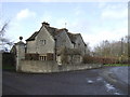
Live-tree carving
On the roadside opposite the entrances to Poulton Priory, with a fine Cotswold house in the background.
Image: © Jonathan Billinger
Taken: 28 Feb 2007
0.03 miles
4
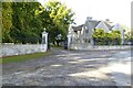
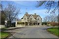
The Lodge to Poulton Priory
The Lodge and gates at the entrance to Poulton Priory. Pevsner describes Poulton Priory as 'a large stone Tudor-Renaissance house of 1895-97 for James Joicey by Charles J. Blomfield (Sir Arthur Blomfield & Son)', though the house doesn't appear to be listed. In medieval times the Gilbertine Priory founded in 1350 by Thomas de Sancto Mauro (or Seymour) stood nearby.
Image: © Philip Halling
Taken: 10 Oct 2022
0.08 miles
5
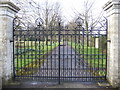
Poulton Priory
Ornate gate and driveway appears largely for decorative purposes as access to the buildings is via a more usable drive at right angles to left of this shot. See Image
Image: © Jonathan Billinger
Taken: 28 Feb 2007
0.13 miles
7
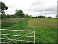
Dry stone wall field boundary alongside the Down Ampney road
Image: © Nick Smith
Taken: 10 Sep 2012
0.21 miles
8
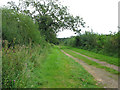
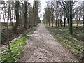
Track to the eat of Poulton
Shown as a metalled road on most maps, see Image
Image: © Nick Smith
Taken: 10 Sep 2012
0.24 miles
10
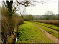
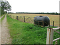
Green Lane south of Poulton
The mapping indicates a metalled surface - not any more!
Image: © Jonathan Billinger
Taken: 17 Mar 2009
0.25 miles