
IMAGES TAKEN NEAR TO
Vicarage Lane, CIRENCESTER, GL7 5HU
Introduction
This page details the photographs taken nearby to Vicarage Lane, GL7 5HU by members of the Geograph project.
The Geograph project started in 2005 with the aim of publishing, organising and preserving representative images for every square kilometre of Great Britain, Ireland and the Isle of Man.

There are currently over 7.5m images from over14,400 individuals and you can help contribute to the project by visiting https://www.geograph.org.uk
Image Map
Images are licensed for reuse under creativecommons.org/licenses/by-sa/2.0
Notes
- Clicking on the map will re-center to the selected point.
- The higher the marker number, the further away the image location is from the centre of the postcode.
Image Listing (58 Images Found)
Images are licensed for reuse under creativecommons.org/licenses/by-sa/2.0
Image
Details
Distance
1
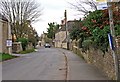
Cricklade Street, Poulton
Cricklade Street, along with London Road and Bell Lane, is one of the village's main streets.
Image: © P L Chadwick
Taken: 11 Mar 2011
0.04 miles

4
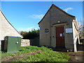
Poulton Telephone Exchange, Glos
Situated in Cricklade Street, this TE is built of Cotswold Stone and has the code SSPOU. It provides telephone and broadband services to 847 residential and 52 non-residential premises in Poulton plus Ampney Crucis, Ampney St Mary, Ampney St Peter, Driffield, Harnhill and Meysey Hampton nearby. A BT green cabinet can be seen to the left of the photo. The numbering ranges of this TE are (01285) 850xxx, 851xxx, the (01285) referring to the Cirencester group of thirteen TEs, and its postcode is GL7 5HS.
Image: © David Hillas
Taken: 26 Oct 2018
0.05 miles
5
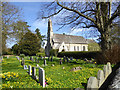
Churchyard and church, Poulton
The Church of St. Michael and All Angels is a grade II listed building of 1873.
Image: © Robin Webster
Taken: 25 Mar 2017
0.06 miles
6
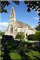
Poulton church
Poulton church is dedicated to St Michael and All Angels. The church is Grade II listed, see: https://historicengland.org.uk/listing/the-list/list-entry/1153465 The church was built in 1873 to a design by William Butterfield.
Image: © Philip Halling
Taken: 10 Oct 2022
0.06 miles
7
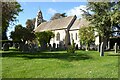
Poulton Church
Poulton church is dedicated to St Michael and was built in 1873 to a design by William Butterfield. The church is Grade II listed, see: https://historicengland.org.uk/listing/the-list/list-entry/1153465?section=official-list-entry
Image: © Philip Halling
Taken: 10 Oct 2022
0.06 miles
8
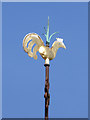
Weather cock, Paulton church
No compass directions, but the brackets beneath appear to be aligned north-south.
Image: © Robin Webster
Taken: 25 Mar 2017
0.06 miles
10
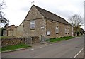
Poulton Village Hall (1), Cricklade Street, Poulton
The hall has a kitchen/servery and has facilities for people with disabilities. It can seat up to 100 people theatre style, or up to 80 at tables. The main hall can be split into two areas.
Image
Image: © P L Chadwick
Taken: 11 Mar 2011
0.07 miles