
IMAGES TAKEN NEAR TO
Bibury, CIRENCESTER, GL7 5FF
Introduction
This page details the photographs taken nearby to GL7 5FF by members of the Geograph project.
The Geograph project started in 2005 with the aim of publishing, organising and preserving representative images for every square kilometre of Great Britain, Ireland and the Isle of Man.

There are currently over 7.5m images from over14,400 individuals and you can help contribute to the project by visiting https://www.geograph.org.uk
Image Map
Images are licensed for reuse under creativecommons.org/licenses/by-sa/2.0
Notes
- Clicking on the map will re-center to the selected point.
- The higher the marker number, the further away the image location is from the centre of the postcode.
Image Listing (9 Images Found)
Images are licensed for reuse under creativecommons.org/licenses/by-sa/2.0
Image
Details
Distance
1
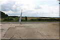
The entrance to the old Bibury Airfield, Ablington
The airfield closed in 1950, and was later Mill Engineers in the 2000s, and is now the Classic Motor Hub. http://classicmotorhub.com/
Image: © David Howard
Taken: 1 Aug 2023
0.02 miles
4
Former RAF Bibury near Garnes Barn
The main site of RAF Bibury was situated either side of the road here. A blister hangar has been rebuilt on the left. The tractor, which has been spreading dung over newly harvested fields, is turning into Garnes Barn, where there are more relics of the WW2 airfield.
Image: © Vieve Forward
Taken: 2 Aug 2020
0.10 miles
5
![A circular walk around Bibury and Ablington [20]](https://s2.geograph.org.uk/geophotos/07/49/06/7490662_ca4bff5e_120x120.jpg)
A circular walk around Bibury and Ablington [20]
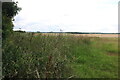
A view across the fields to the curiously named The Hanger Piece, the home of an engineering company. Some of the buildings remain from RAF Bibury. RAF Bibury was built in 1939 for use as a relief landing ground. In the Battle of Britain the airfield had very few buildings and a grass runway and was used to base detachments of fighter aircraft. The site was not used for flying after 1944 and was home to a maintenance unit until it closed in 1945.
The walk starts at Arlington Corner and follows a footpath to Ablington, where the River Coln is crossed, and then a byway northeast to Saltway Barn. Another byway, the historic Salt Way, is then followed southeast before a right turn onto a bridleway which runs south past Hale Barn to Bibury. The River Coln is recrossed at Bibury Mill and a footpath is then followed back to the starting point. Just over 5 miles.
Image: © Michael Dibb
Taken: 10 May 2023
0.10 miles
6
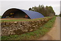
A modern 'blister' barn on the site of former RAF Bibury
View looks southwards towards Ablington.
Image: © Roger Davies
Taken: 25 Apr 2008
0.15 miles
7
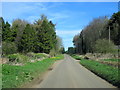
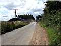
Road From Ablington Passing Through Small Wood
Image: © Roy Hughes
Taken: 25 Mar 2017
0.16 miles
8
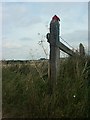
Red glove, blue post
On a gatepost by the Salt Way near Bibury.
Image: © Katy Walters
Taken: 15 Aug 2006
0.17 miles
9
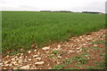
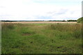
Winter cereals growing on the former site of RAF Bibury
Although originally created on Ablington Down as a relief landing ground for training purposes RAF Bibury served as a Battle of Britain fighter station. During the summer of 1940 Hurricanes and Spitfires of 87 and 92 squadron were at various times based here. Indeed, the airfield was strafed by a Ju88 on the 19th August 1940 with one fatality. The German aircraft did not get far as it was subsequently shot down by Spitfires scrambled from RAF Bibury. A much more peaceful scene now.
Image: © Roger Davies
Taken: 25 Apr 2008
0.22 miles