IMAGES TAKEN NEAR TO
Saxon Way, FAIRFORD, GL7 4GZ
Introduction
This page details the photographs taken nearby to Saxon Way, GL7 4GZ by members of the Geograph project.
The Geograph project started in 2005 with the aim of publishing, organising and preserving representative images for every square kilometre of Great Britain, Ireland and the Isle of Man.

There are currently over 7.5m images from over14,400 individuals and you can help contribute to the project by visiting https://www.geograph.org.uk
Image Map
Images are licensed for reuse under creativecommons.org/licenses/by-sa/2.0
Notes
- Clicking on the map will re-center to the selected point.
- The higher the marker number, the further away the image location is from the centre of the postcode.
Image Listing (17 Images Found)
Images are licensed for reuse under creativecommons.org/licenses/by-sa/2.0
Image
Details
Distance
1
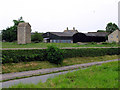
Disused Water Tower: Fairford
This view of the tower was taken from the intersection.
Image: © Pam Brophy
Taken: 28 Jun 2005
0.09 miles
2
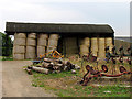
Barn in Fairford
The square being mostly farmland has a number of farm buildings.
Image: © Pam Brophy
Taken: 22 Jun 2005
0.09 miles
3
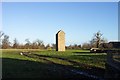
Disused water tower, Milton End, Fairford.
An unusual sight, almost a folly.
Image: © Jonathan Billinger
Taken: 28 Nov 2006
0.11 miles
4

Stone Stile, Fairford
Off "the Garrets" on Gloucestershire footpath BFA11 looking West. The view from the road is Image
Image: © Mr Red
Taken: 13 Jan 2022
0.12 miles
5
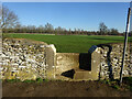
Stone Stile, Fairford
Off "the Garrets" on Gloucestershire footpath BFA11 looking East. The view from the field is Image On the RH abutment there is a Benchmark representing 96.0 m ASL.
Image: © Mr Red
Taken: 13 Jan 2022
0.12 miles
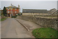
7
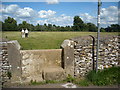
Concrete stile
This concrete stile is built on the model of stone stiles in the district which consist of a single upright slab.
Image: © Vieve Forward
Taken: 3 Jul 2016
0.12 miles
8
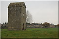
Disused water tower, Fairford
An unusual disused water tower in Fairford.
Image: © Philip Halling
Taken: 19 Nov 2011
0.14 miles
9
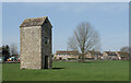
Old Water Tower in a Field
A Wr Twr (dis) in map-speak, this substantial building is no longer in use.
Image: © Des Blenkinsopp
Taken: 30 Mar 2021
0.14 miles